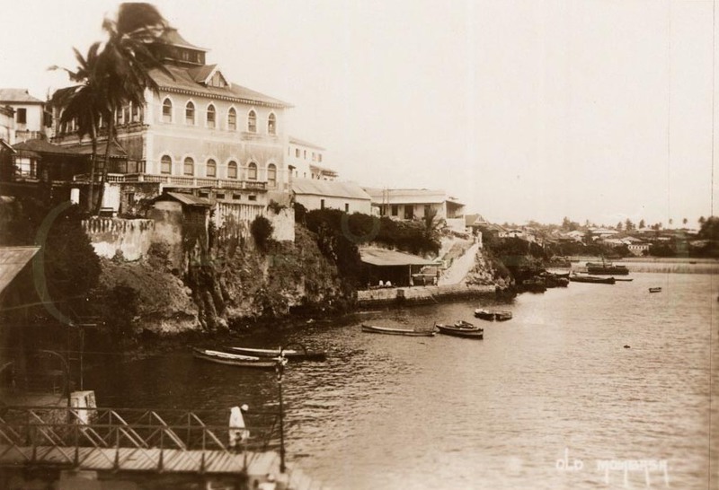
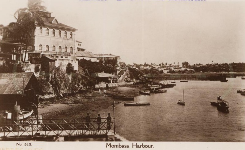
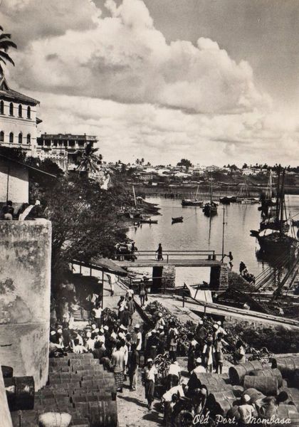
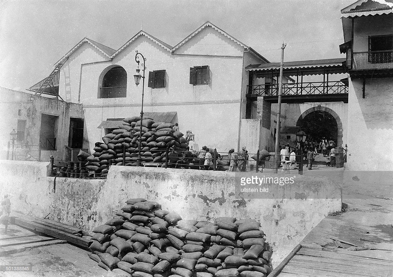
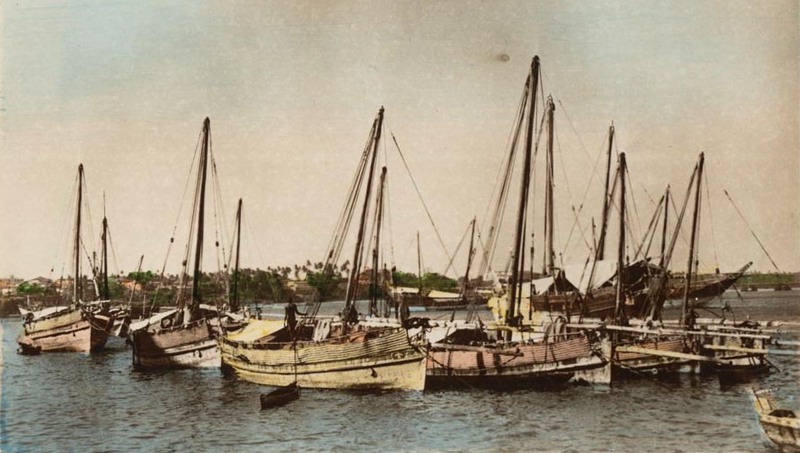
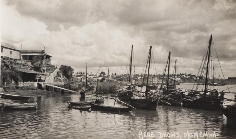
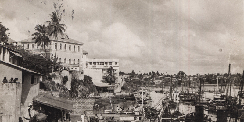
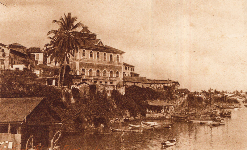
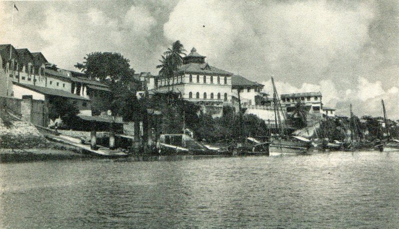
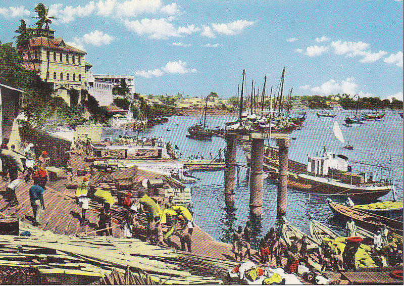
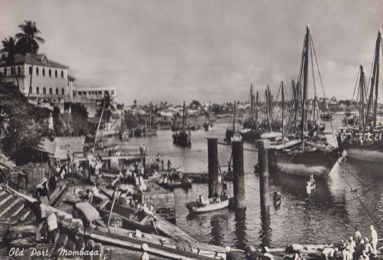
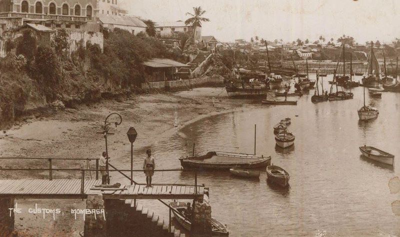
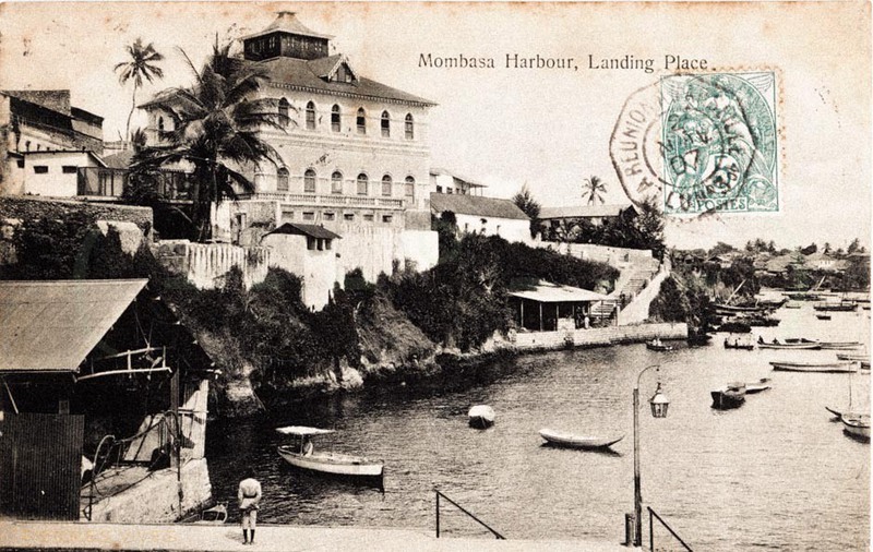
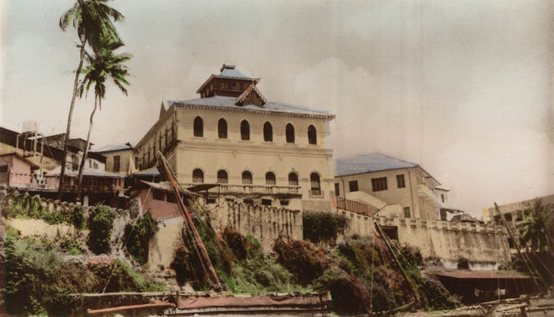
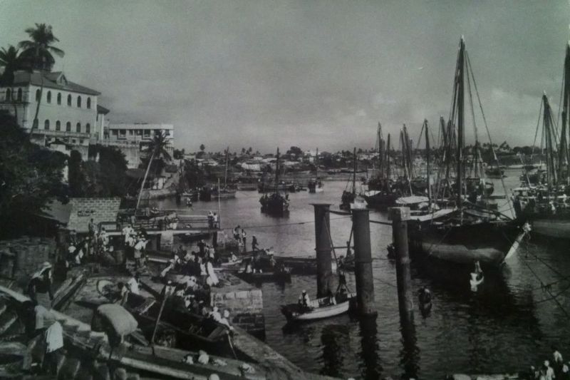
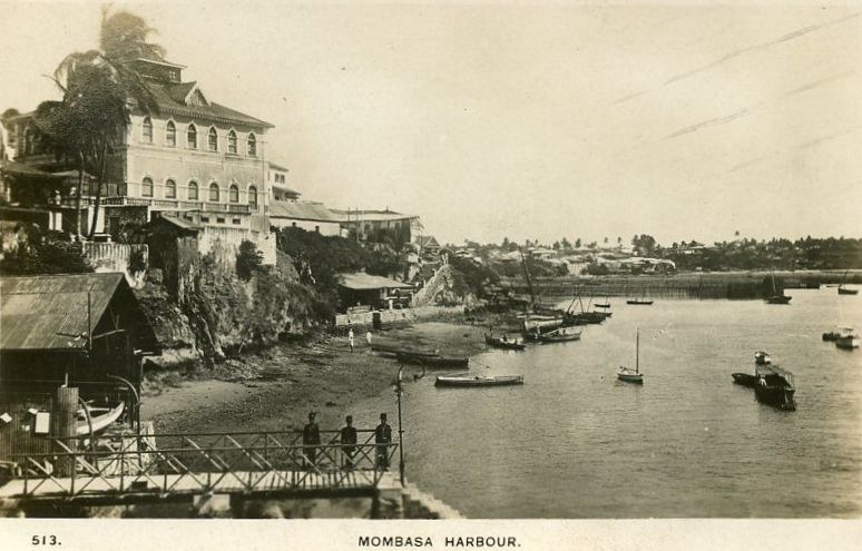
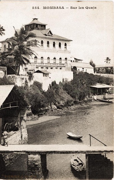
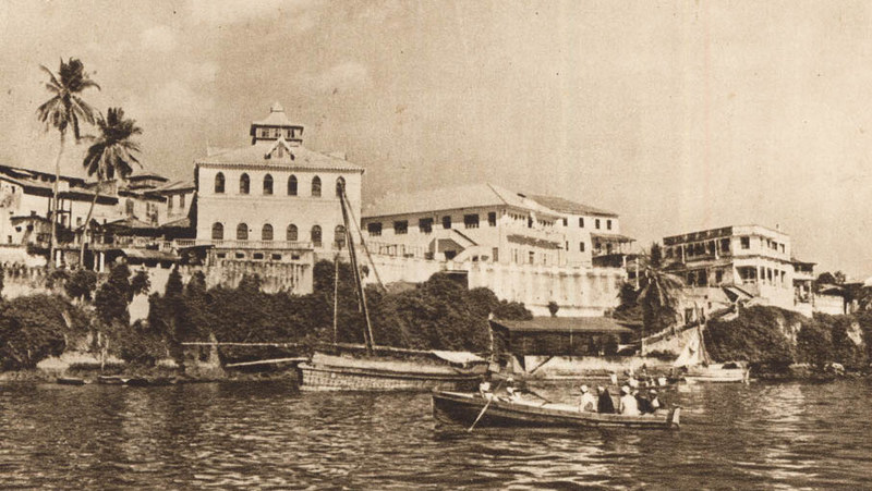
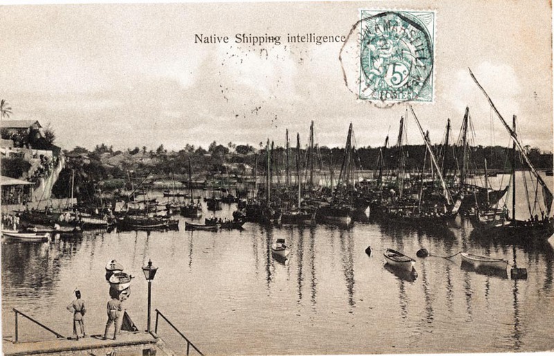
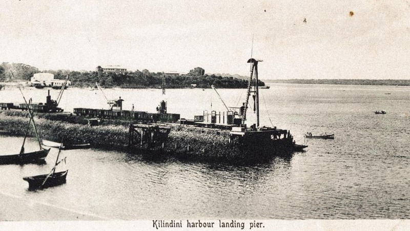
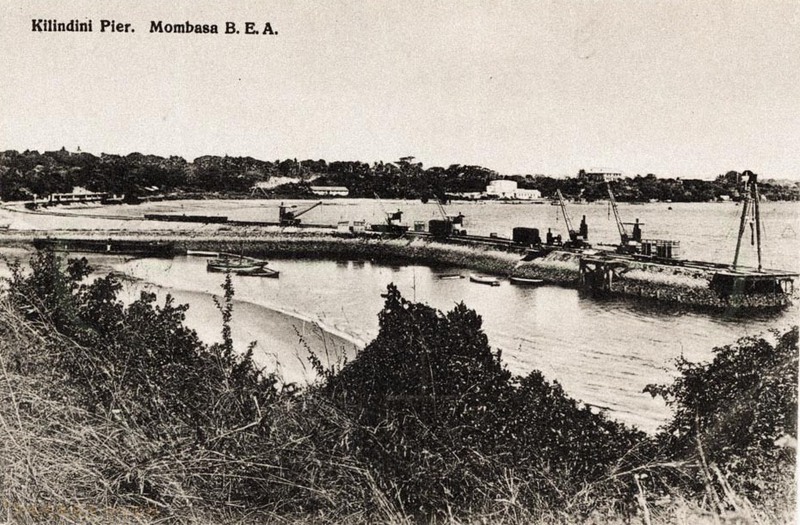
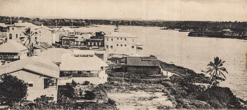
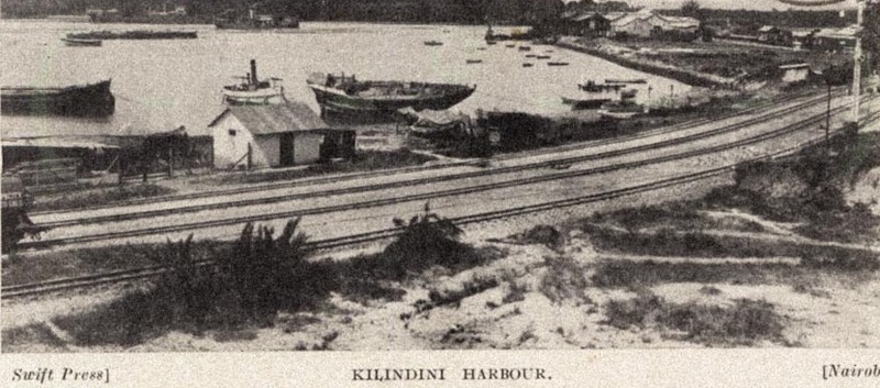
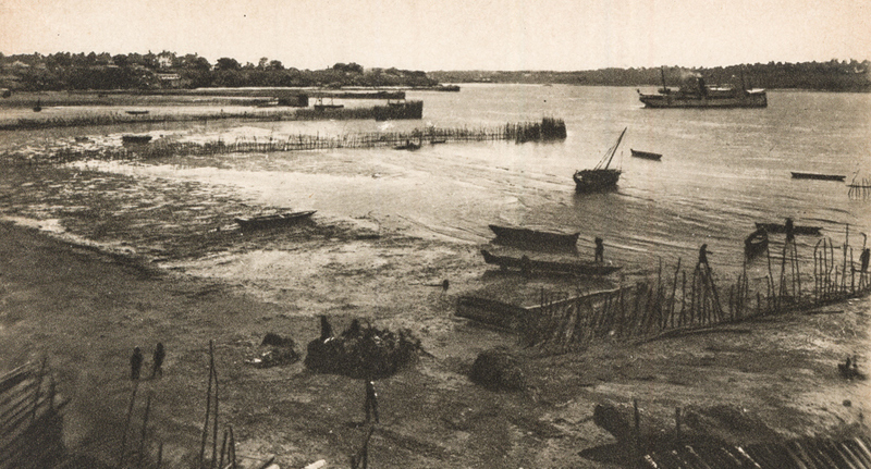
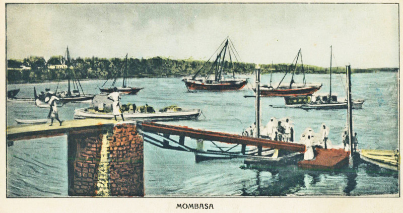
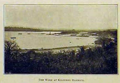
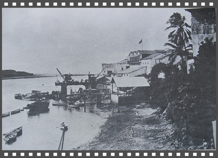
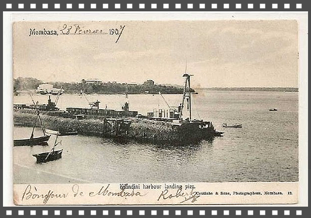
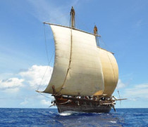
Historic Old Port of Mombasa, in the 1890’s lack of facilities to offload Railway equipment led to the development of Kilindini as a port on the west side of the island.
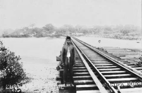
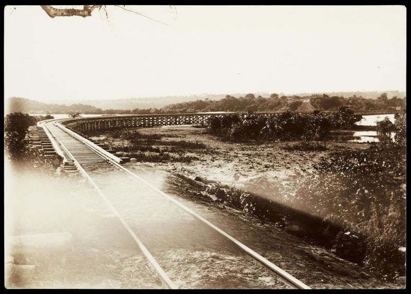
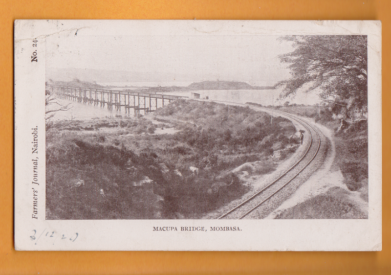
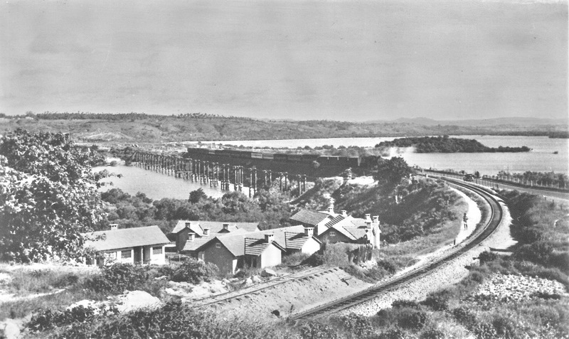
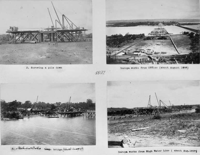
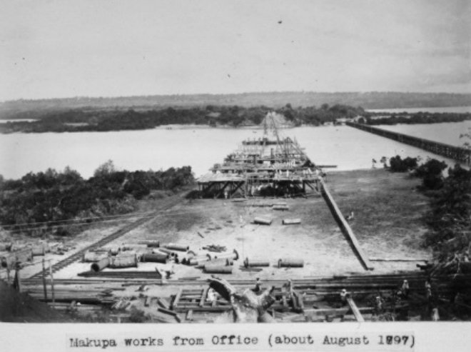
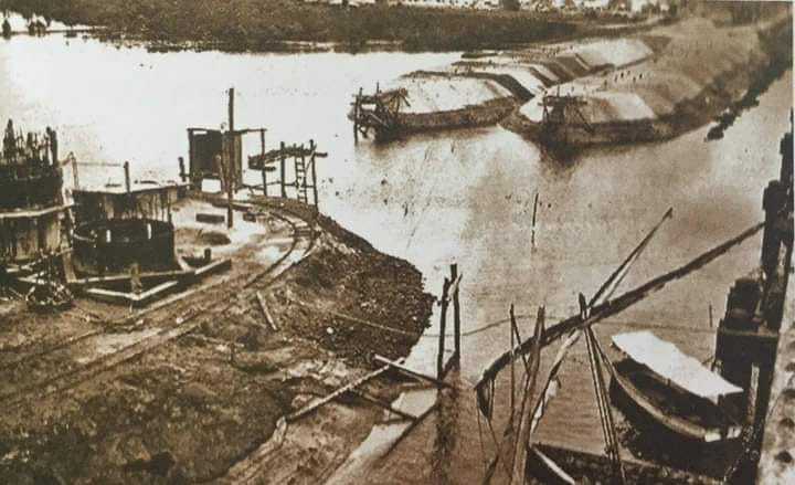
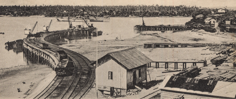
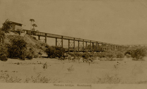
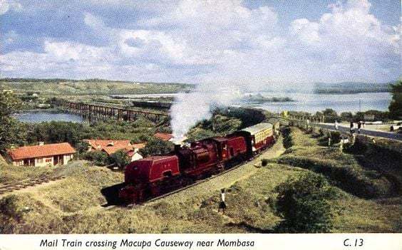
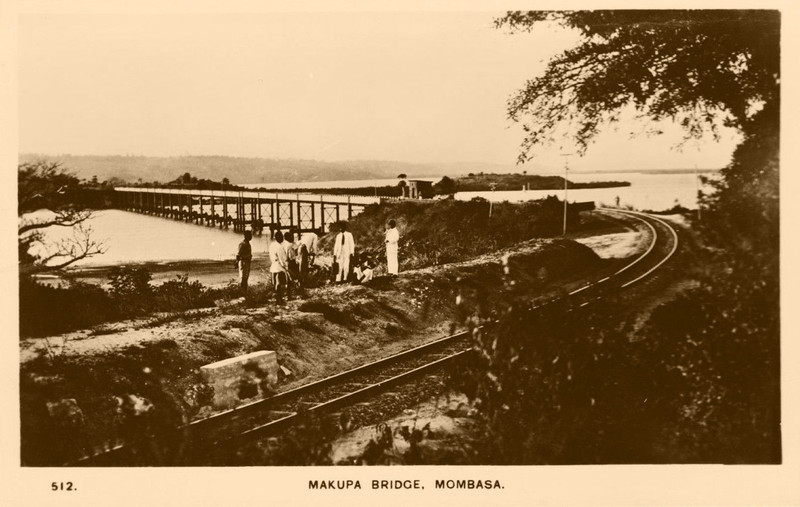
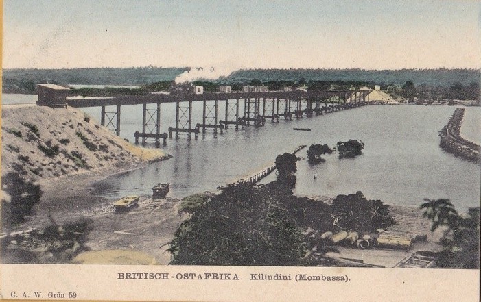
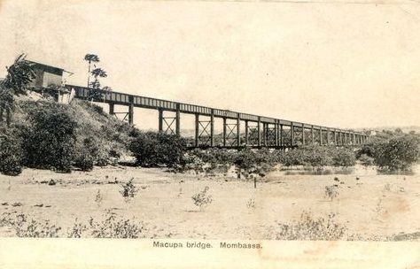
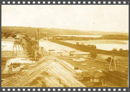
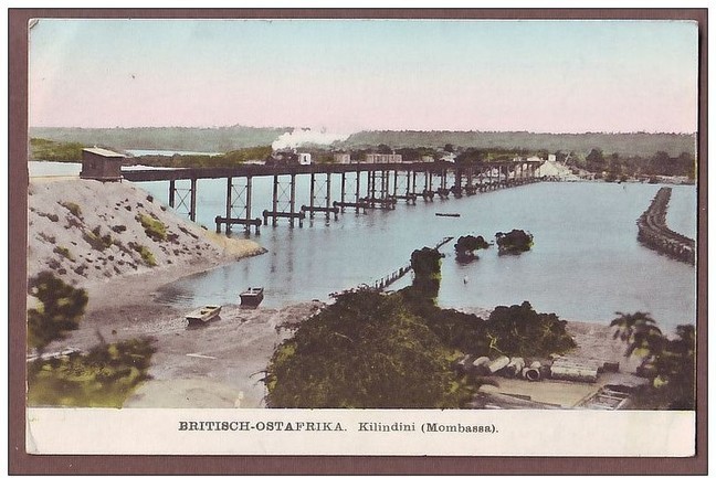
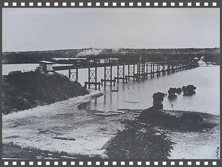
Macupa trestle bridge 1898
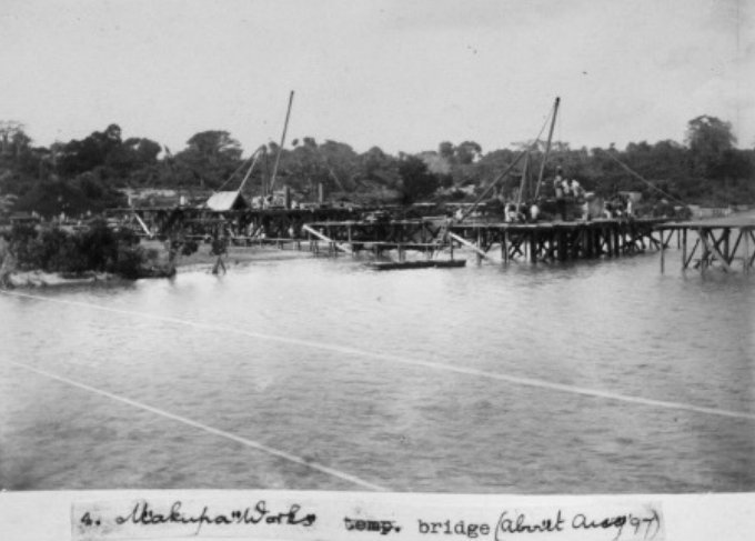
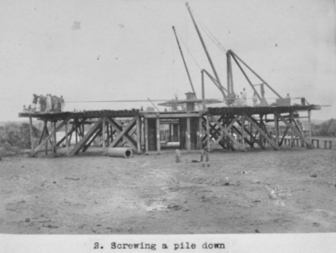
Macupa viaduct was started with imported timber with fear of waters infestation Teredo Navalis (Teredo navalis, commonly called the naval shipworm or turu, is a species of saltwater clam,
a marine bivalve mollusc in the family Teredinidae)
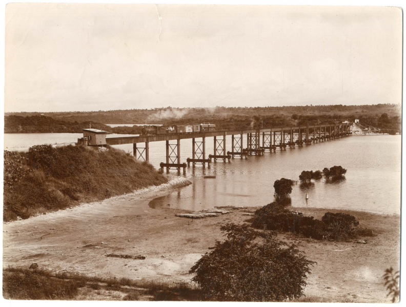
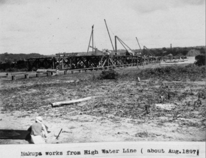
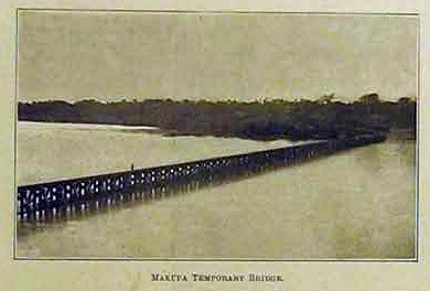
In 20th April 1896 this was constructed temporarily viaduct that was 1,732 foot long, completed on 04th August, in 92 working days.
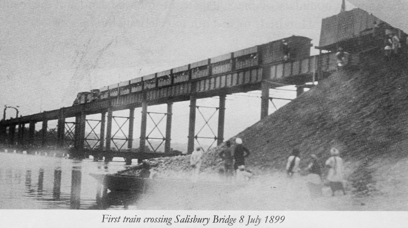
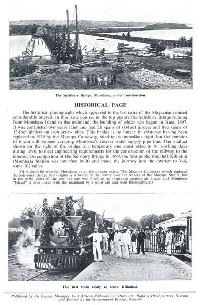
Iron Bridge (Salisbury named after Lord Salisbury) was on order from England.. permanant bridge was started in June 1897, completed on June 28th, 1899, and opened for traffic on July 08th
1901.
The first construction difficulty was crossing from Mombasa
Island at Macupa to the Mainland. A temporary wooden viaduct that was built in 90 days, while the main bridge was erected alongside.
Later named Salisbury Bridge, it was completed in 1899. The original Makupa Bridge was also known as the Salisbury Bridge. Named after Lord Salisbury who was British Prime Minister from 1895 to 1902
(and previously from 1885 to 1892).
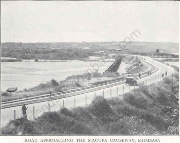
The Makupa Causeway (Swahili pronunciation: [maˈkupa]) is a
causeway linking Mombasa island to the Kenyan mainland. The road runs for approximately one and a half miles between the Magongo Circus and Makupa Circus. The causeway dissects Tudor Creek to
the east and Port Reitz Creek to the west.
The causeway is one of three road links between the island
and the Kenyan mainland – the other two being the Nyali Bridge and the Kipevu Causeway.
Built in 1929 by the Colonial British Government, the causeway replaced the Britannia Bridge which had been completed in 1899. In addition to the rail crossing, the causeway incorporated a road crossing. It was originally called the Macupa Causeway. It spans approximately 1200ft (365m).
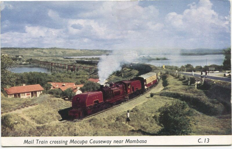

The Macupa Causeway Construction


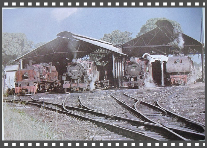
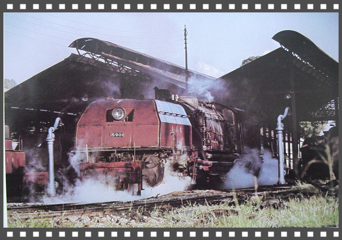
 Makupa Bridge, Click on Photo
Makupa Causeway
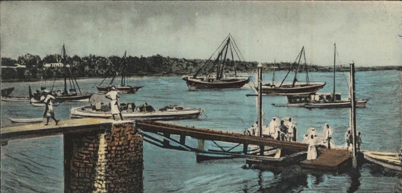
Narrated by Siraj Murbe …..Makupa, Kupa is the word we use to describe the movement of the tide out to sea. Ebbing of tide. Anyway this point is the shallowest place anywhere around the Island. During low tide one can walk across easily.
------------------------------------------------------------------------------------------------------------
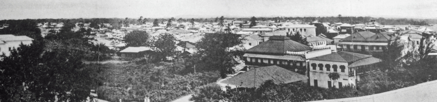
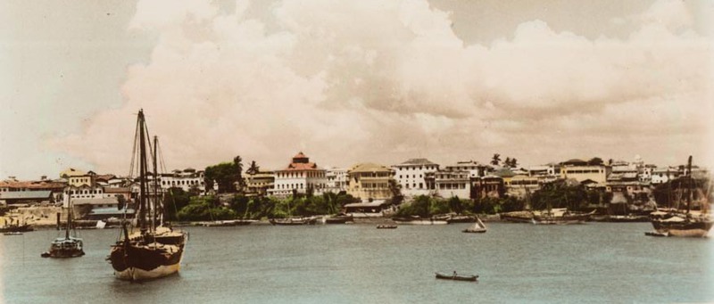
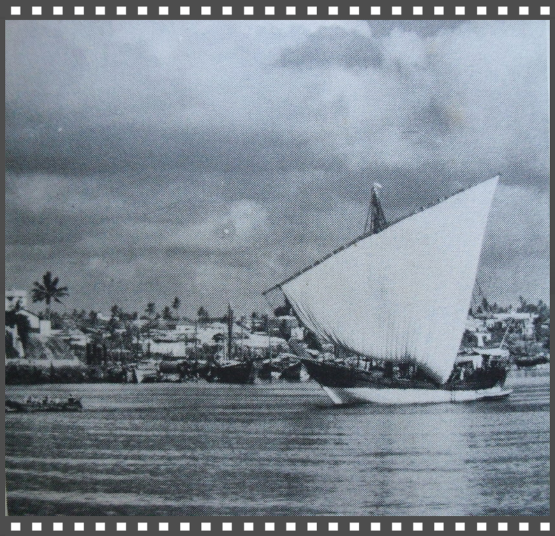
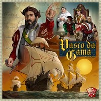
Long before Nairobi, or any other hinterland town, was established, Mombasa was an ancient city of more than 1,000 years. Mombasa old port was a gateway to the interior for hundreds of years where Arab traders came with their dhows and the Portuguese navigator Vasco da Gama arrived in the 15th century – signalling the beginning of the end of the Arab Sultanates and fiefdoms.
However, Mombasa old port, which handled the maritime traffic of the day, had no capacity to serve the influx of railway builders, soldiers of fortune, merchants of trade, Christian missionaries/explorers and the rest of the impedimenta introduced by the British Empire.
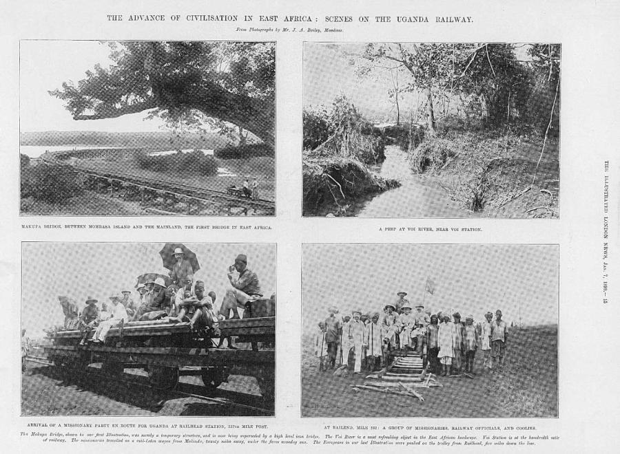
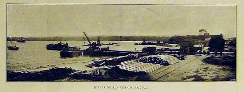
A new port was needed. But since a port cannot operate without the hinterland transport infrastructure, a decision was made by the British colonialists to build a railway line. The British also wanted to protect their strategic interests in Uganda from the Germans. So on 11 December 1895, Mr George Whitehouse, a British engineer, who had previously been involved in the construction of railways in England, South Africa, India and South America arrived in Mombasa to oversee the building of the Uganda Railway.
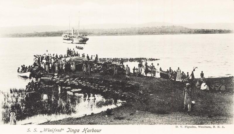
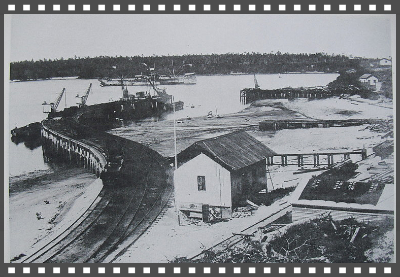
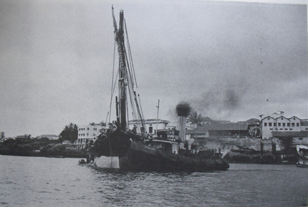
The growth of present day Kilindini Harbour started in 1896 with one jetty, following the arrival of the steamship "S.S. Ethiopia" carrying material for the building of the Uganda Railway. Approximately 32,000 workers were imported from India to build the railway which reached Nairobi in 1899. At that time, Nairobi was nothing more than a seasonal swamp.
The construction of the railway continued to the lakeside and finally reached Kisumu (then Port Florence – named after the wife of George Whitehouse) in December 1901. On 20 December 1901, George Whitehouse sent a telegram to Lord Salisbury, the British Prime Minister, informing him that the rails of the Uganda railway had reached the shores of Lake Victoria – 930 km from Mombasa.
Although Whitehouse had been involved in previous construction of railways, none of them would match up to the difficulties he faced in building the Uganda railways across East Africa. The most difficult part of the railway's construction was the 330 miles that lay between Mombasa and Nairobi, a section which was plagued by untold misfortune, among them the infamous man-eating lions of Tsavo, diseases, drought and desertions.
By the time the railway reached Kisumu, it had cost the British taxpayer 5.5 million pounds, claimed the lives of 2,500 men, mainly from tropical fever and diseases and displaced many Africans from their habitat. At that time, there was no environmental impact assessment and any resistance from local communities was met with the might of the imperialists' guns.
How did the term "Lunatic Express" come about? Well, due to the shaky-looking wooden trestle bridges, enormous chasms, prohibitive cost, hostile tribes, tropical diseases, and man-eating lions pulling railway workers out of carriages at night, the name "Lunatic Line" certainly seemed to fit.
As reported by the London Magazine Truth in 1896, this is what one radical British MP (Henry Labouchere) said in Parliament:
“What it will cost no words can express;
What is its object no brain can suppose;
Where it will start from no one can guess;
Where it is going nobody knows;
What is the use of it none can conjecture;
What it will carry there’s none can define;
And in spite of George Curzon’s superior lecture,
It clearly is naught but a lunatic line.”
Sir Winston Churchill who regarded the Uganda Railway as a brilliant conception, said of the project:
"The British art of 'muddling through' is here seen in one of its finest expositions. Through everything—through the forests, through the ravines, through troops of marauding lions, through famine, through war, through five years of excoriating Parliamentary debate, muddled and marched the railway".
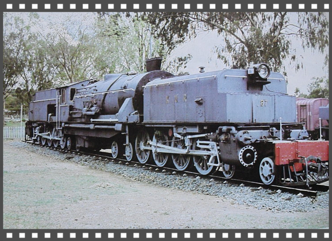
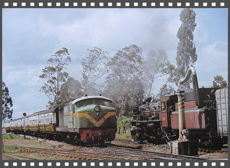
In February 1926, the name of the railway was changed from "The Uganda Railway" to "The Kenya – Uganda Railway" and later to "East African Railways and Harbours". Urbanization in Kenya begun with the railway and for a long time it formed the socio-economic backbone of the entire East African Region. Imports and exports through the port of Mombasa were transported by the railways and towns developed along the railway line between Mombasa and Kampala.
The development of Kilindini port and inland waterways shipping on lakes Victoria, Kyoga and Albert began and went concurrently with the building of the Uganda Railway. Disassembled ships were transported from the United Kingdom by sea to Mombasa and then by rail to Kisumu where they were reassembled to provide a service to Port Bell in Uganda and, later, other ports on Lake Victoria. An 11-kilometre rail line between Port Bell and Kampala was the final link in the chain providing efficient transport between the Ugandan capital and the open sea at Mombasa, more than 1,400 km apart.
Interestingly, the Uganda Railway facilitated the development of shipping services on Lake Victoria as far back as 1898 when it launched the 110 ton steam ship “Mackinnon” at Kisumu, having assembled the vessel from a "knock down" kit shipped from the UK. Between 1901 and 1925, eight passenger and cargo ferries were launched on Lake Victoria while four paddle steamers were launched on Lakes Kyoga and Albert.
Without the Uganda Railway, maritime services on inland waterways of East Africa would not have been possible nor the development of Mombasa port. As the volume of trade grew as a result of the railway, the need for the expansion of the port was inevitable both in commercial and military terms. Mombasa port development began and proceeded upstream from 1926 to 1958 with deep water general-cargo berths.
-------------------------------------------------------------------------------------------------
George Whitehouse landed at the port of Mombasa on December 11th 1895.He had been commissioned as the Chief engineer of the great new rail road and was feted for his involvement in railway construction in England, South Africa, Mexico, South America and India.
One might suppose that given his experience in many a country, Whitehouse was already predisposed to face whatever challenges railway construction might have to offer.
https://www.theeagora.com/mombasa-to-nairobi-the-rail-road-story-part-1/
--------------------------------------------------------------------------------------------------
The Makupa Causeway (Swahili pron. [maˈkupa]) is a causeway linking Mombasa island to the Kenyan mainland. The road runs for approximately one and a half miles between the Magongo Circus and Makupa Circus. The causeway dissects Tudor Creek to the east and Port Reitz Creek to the west.[1]
The causeway is one of three road links between the island and the Kenyan mainland – the other two being the Nyali Bridge and the Kipevu Causeway.
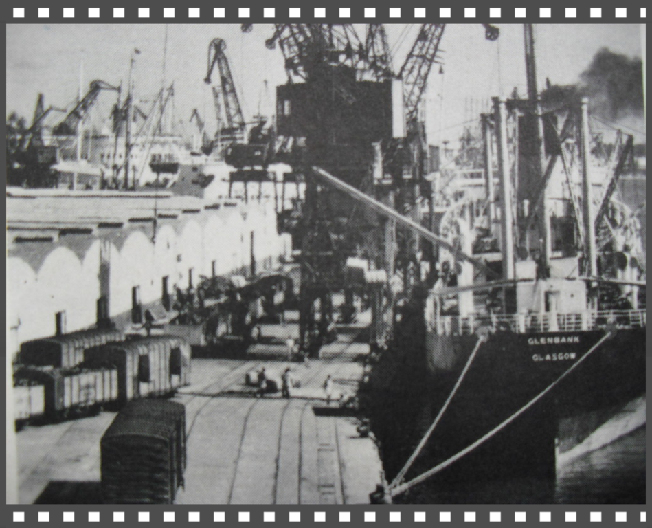
TYNE BUILT SHIPS
A history of Tyne shipbuilders and the ships that they built
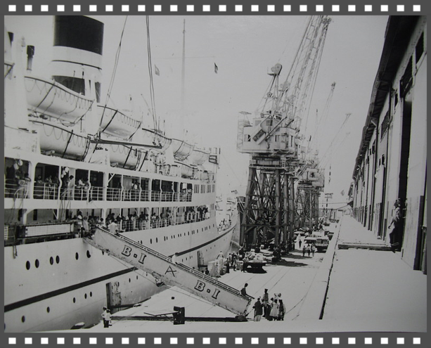
British India Line
Kampala / Karanja / Kenya / Uganda
Click Below to Enlarge Photo...
Makupa Causeway
Initial crossings around the area were made by ferries from Mombasa to the Mainland.
Macupa trestle bridge, the first construction difficulty was crossing from Mombasa Island at Macupa to the Mainland. A temporary wooden viaduct was built in 90 days, while the main bridge was erected
alongside. Later named Salisbury Bridge, it was completed in 1898. Drive-in-Cinema was also located on the other side and so were the famous areas such as Kibarani, Changamwe. Jomvu
market.
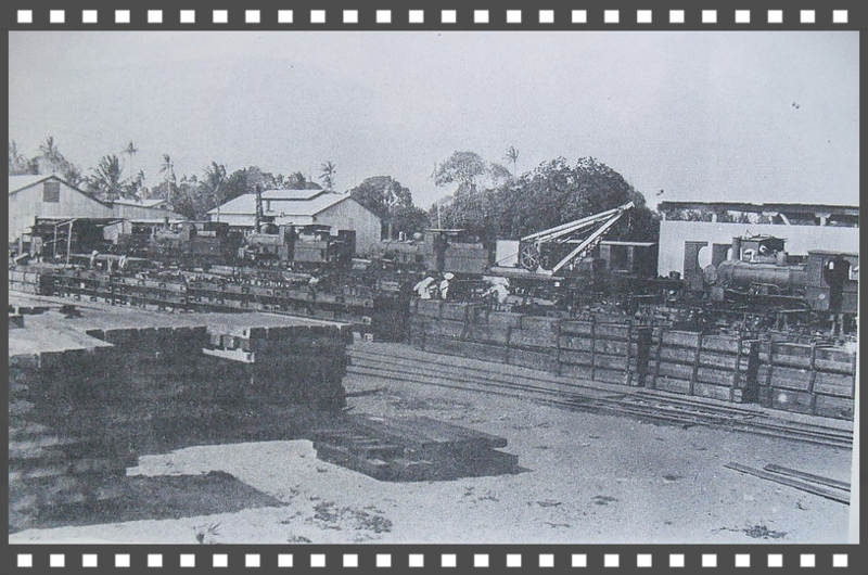
http://www.thepeople.co.ke/34978/ever-wonder-how-they-build-these-engineering-marvels/
http://kenyaengineer.co.ke/index.php/n-e/nu/f/169-history-and-development-of-bridges-in-kenya
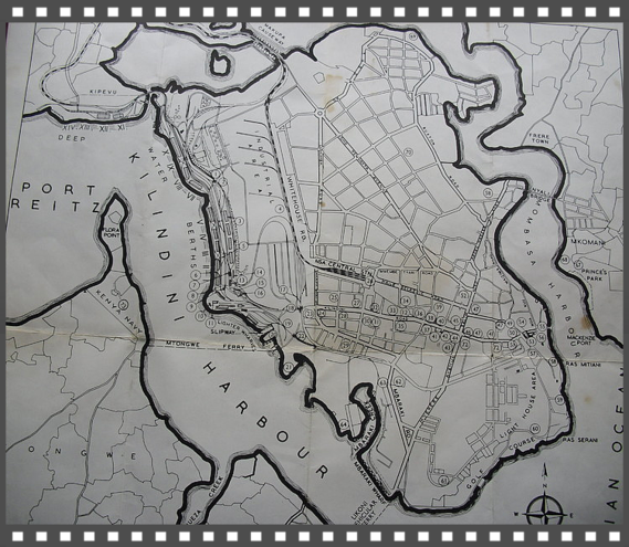
Kilindini/Makupa
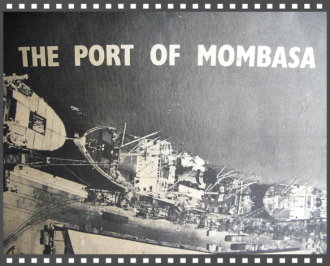
History, From the days of dhows to containerisation
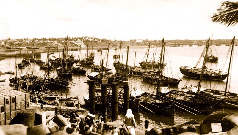
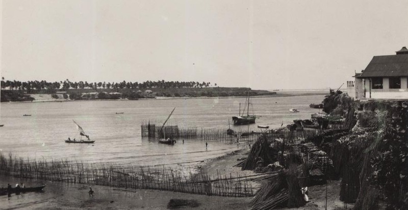
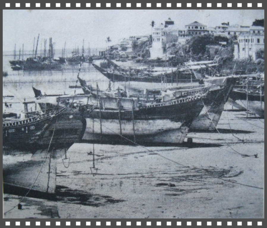
THE PORT OF MOMBASA can trace its history back many centuries to a time when dhows called at the Old Port on the north side of Mombasa Island.
The Old Port is next to Fort Jesus, which was built by the Portuguese navigator Vasco da Gama. This was during the famous spice trade between the Arabian Gulf, the east coast of Africa, the Indian subcontinent and the Far East when navigators were looking for a new route to the Far East.
In the 18th and 19th centuries East Africa was colonised by various nations including Great Britain and Germany. In the 1890s the region was partitioned, with Tanzania coming under German control and Kenya and Uganda being controlled by Britain.
http://www.kpa.co.ke/About%20Us/Pages/History.aspx
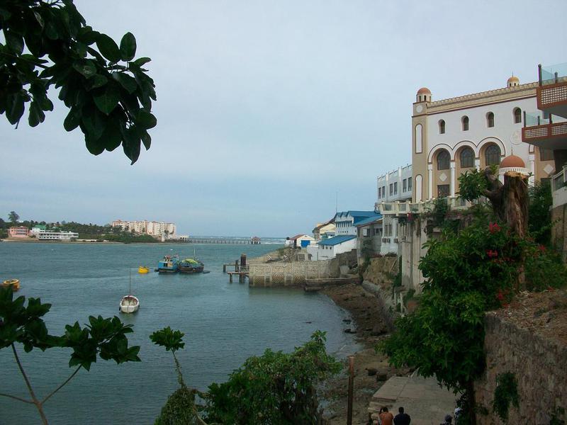
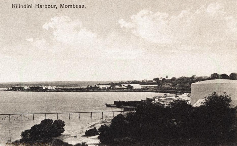
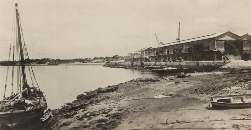
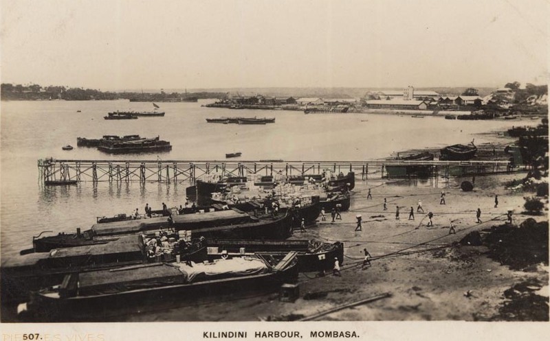
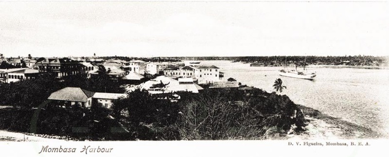
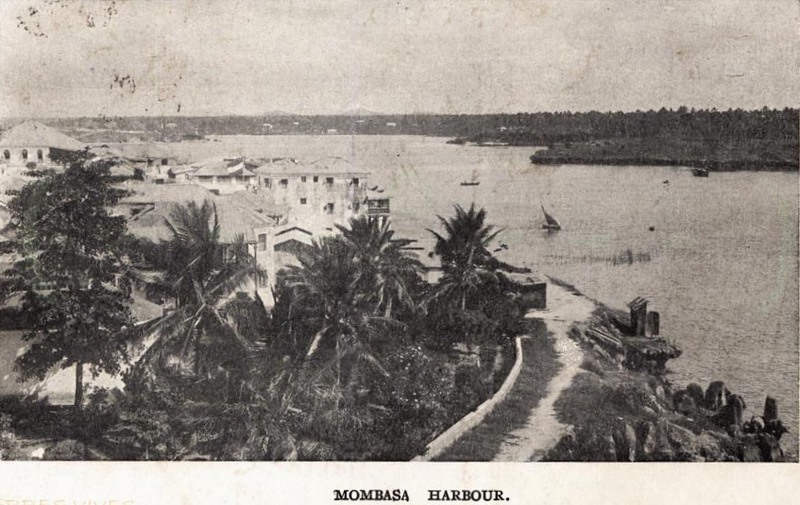
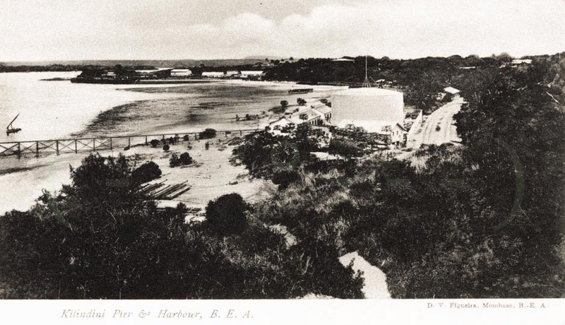
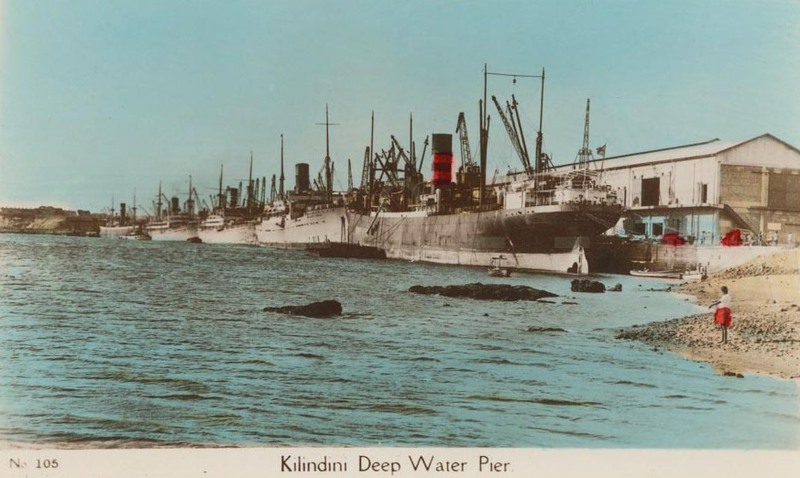
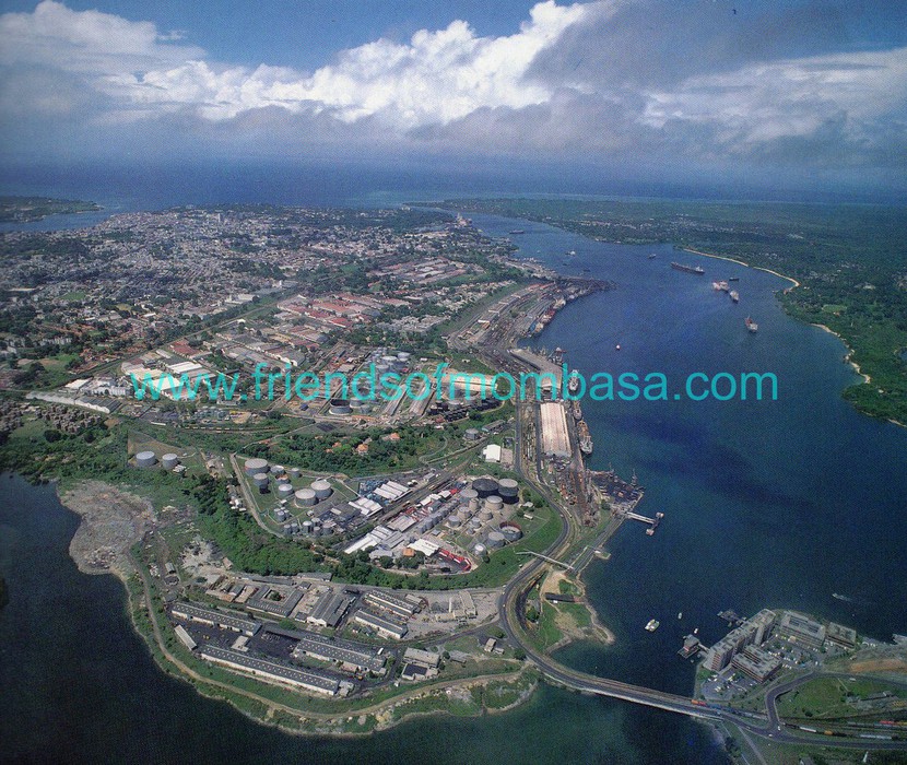
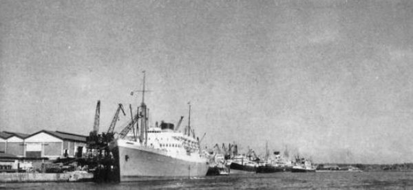
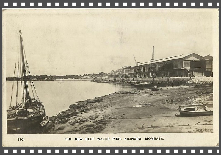
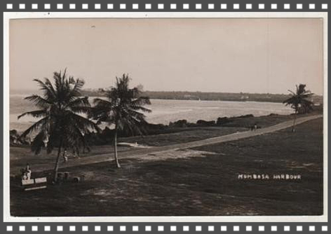
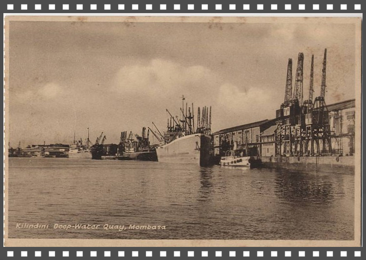
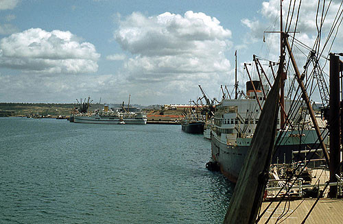
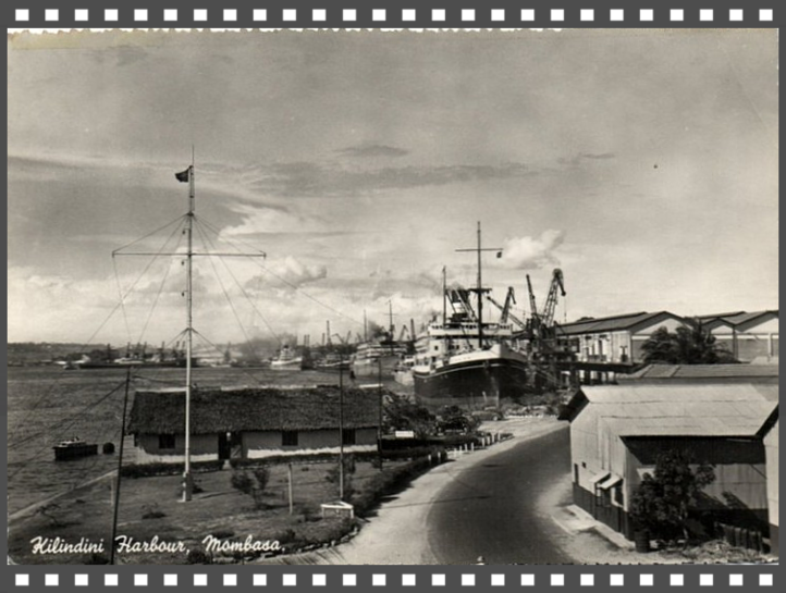
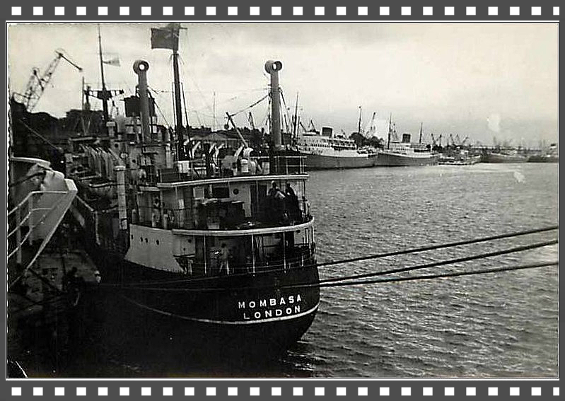
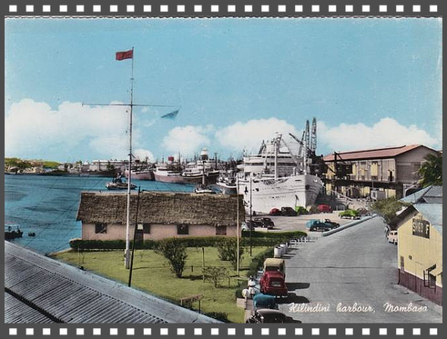
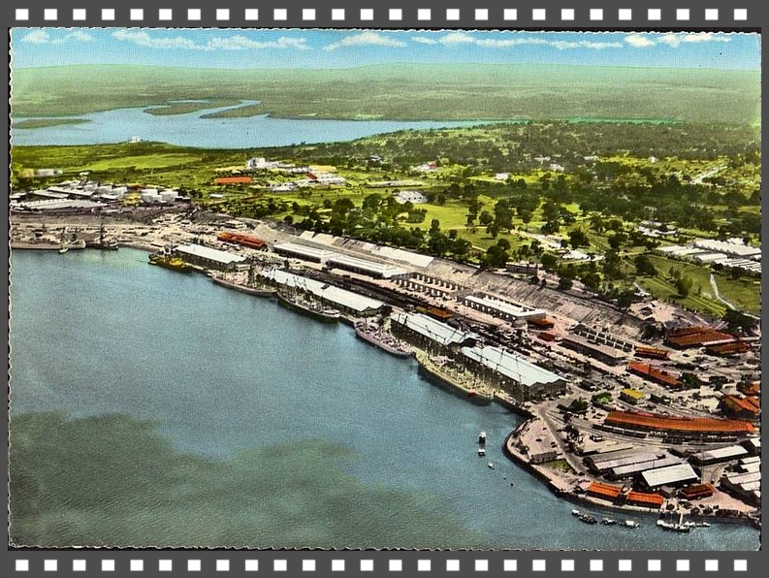
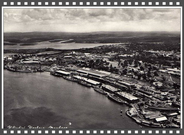
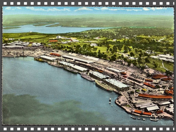
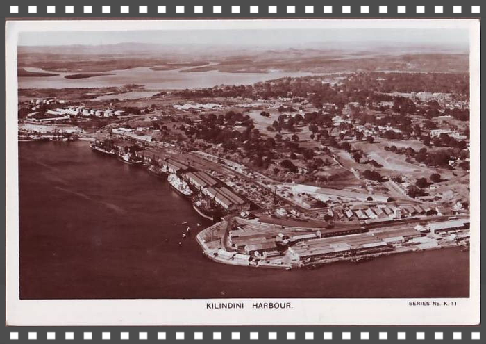
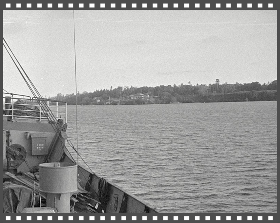
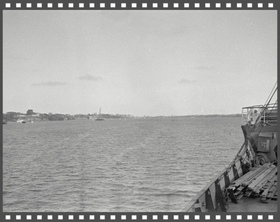
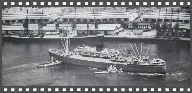
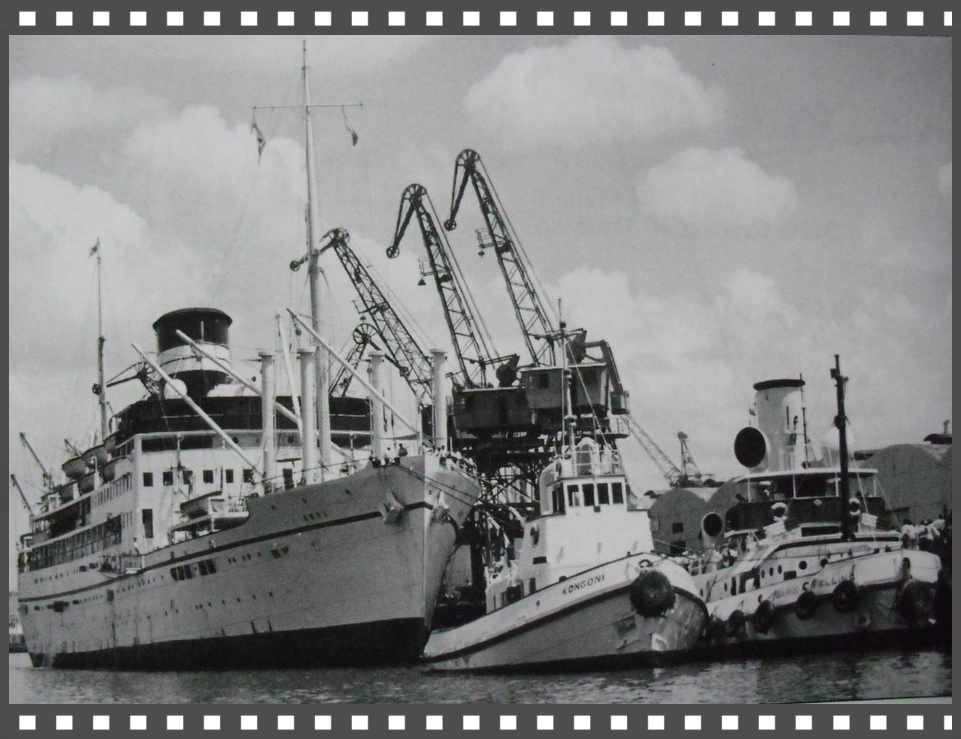
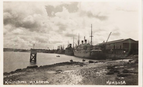
Kilindini Harbour is a large, natural deep-water inlet extending inland from Mombasa, Kenya. It is 25-30 fathoms (45-55 meters) at its deepest center. It serves as the harbour for Mombasa, with a hinterland extending to Uganda and Sudan. Kilindini Harbour is the main part of the Port of Mombasa, the only international seaport in Kenya. It is managed by the Kenya Ports Authority (KPA). Apart from cargo handling, Mombasa is frequented by Cruise ships.
"Kilindini" is an old Swahili term that means "deep". The port is so called because the channel is naturally very deep. Kilindini Harbor is an example of a natural geographic phenomenon called a ria, formed millions of years ago when the sea level rose and engulfed a river that was flowing from the mainland.
ROYAL NAVY HARBOUR DEFENCES - KILINDINI HARBOUR, MOMBASA
 Click above
Historical Timeline
1890
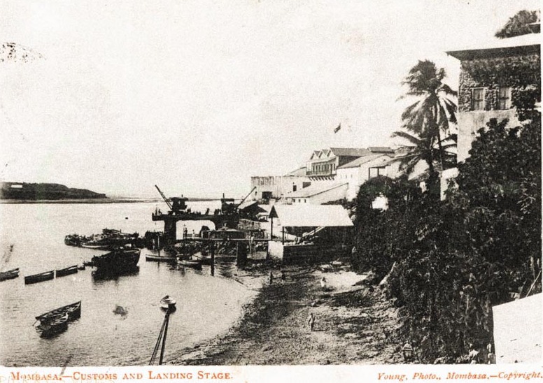
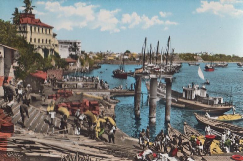
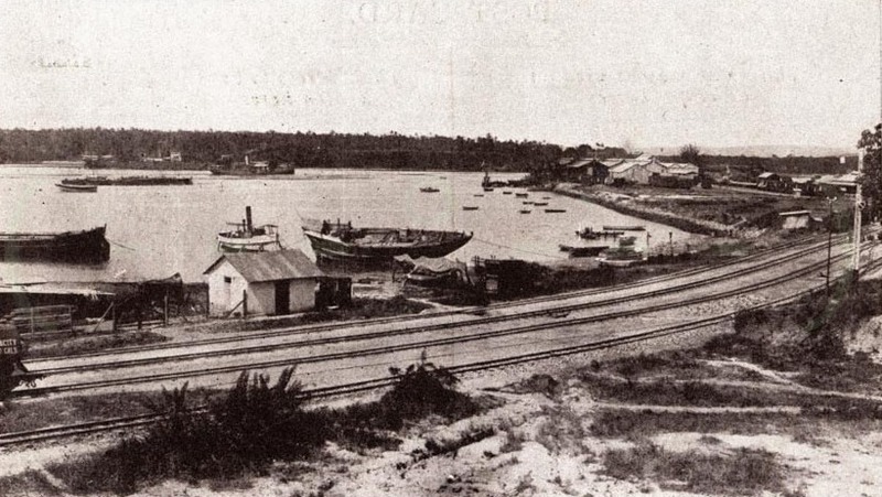
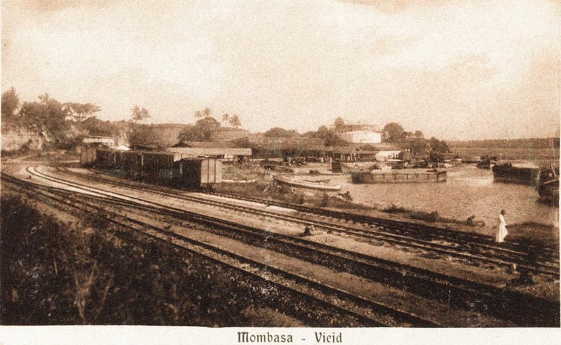
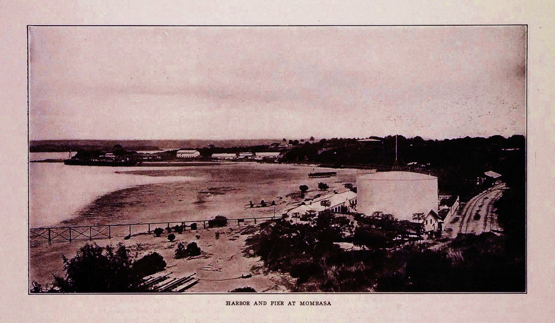
The history of The Port of Mombasa dates back many centuries from the existence of the Old Port. The Port served dhows from India, Arabian Gulf and Far East. It is located near Fort Jesus at Mombasa Old Town. In 1890, Kenya and Uganda became a British Protectorate under the Imperial British East Africa (IBEA). The colonial government saw a need to create infrastructure inland to open up the area for effective administration, hence the construction of the Kenya- Uganda Railway (1895-1902). Coupled with increased activities at the Port there was need for a more spacious and convenient place to meet the demand and for construction of a rail network. Therefore the Port of Mombasa was relocated to the Kilindini Harbor West of Mombasa Island. The development of the present Port of Mombasa commenced in 1896 when the first Jetty, used for discharging materials for the construction of the railway line was built at Kilindini.
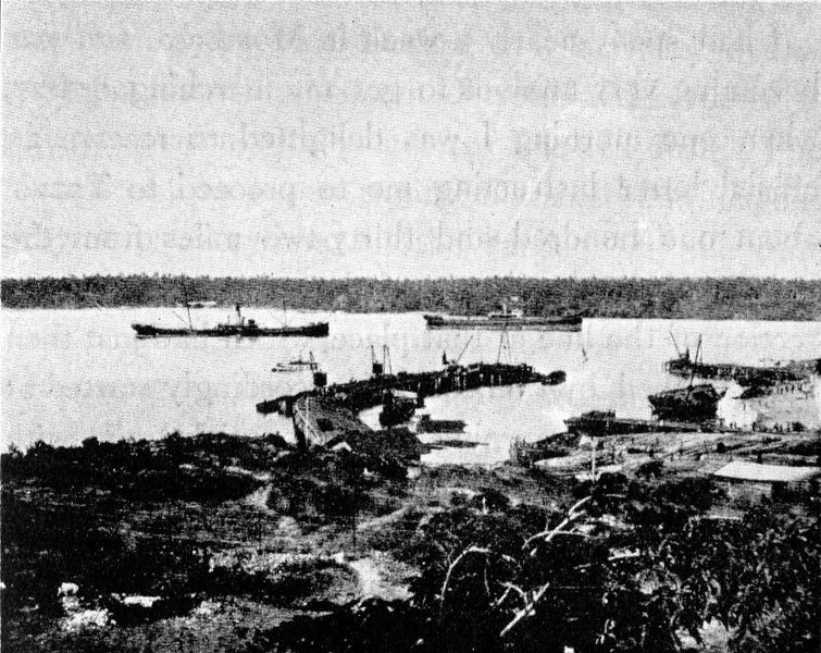
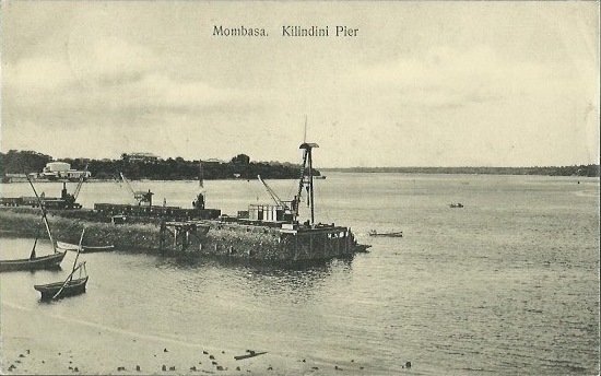
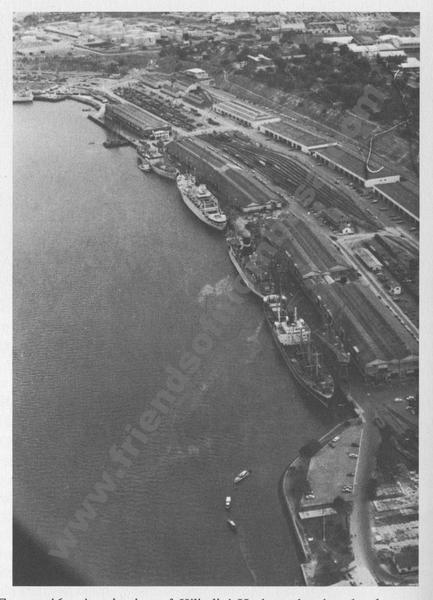
North Lighter Wharf
1907
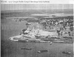
In 1907 a wharf, the North Lighter Wharf was built with quay length of 168 meters long to handle rail-borne goods and other imports and exports. The north lighter quay had four lighter handling points. Later in 1954 a South lighter wharf built with 8 stub-head jetties to keep up with expansion rate.
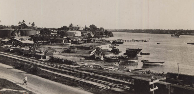
Berth No. 9
1913
In 1913, berth no 9 was constructed to handle then Kenya's leading mineral export (Soda ash).
Berth Nos. 1 and 2
1926
Berth nos. 1 and 2 were completed in 1926, supported by double storied sheds.
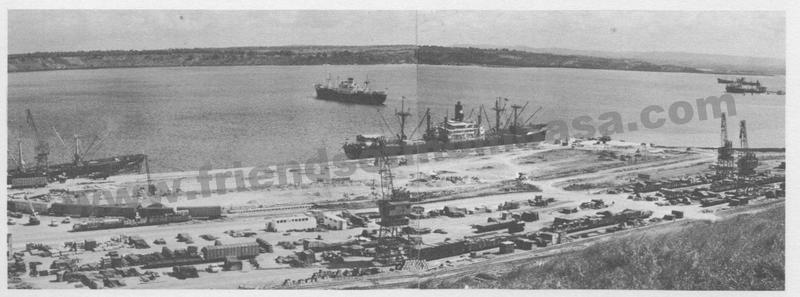
Berth Nos. 3,4, 5 and the Shimanzi Oil Terminal (SOT)
1929 - 1931
In 1929, berth nos. 3 and 4 were completed and were supported by ordinary transit sheds. In 1931, no. 5 and the Shimanzi Oil Terminal (SOT) were completed. The SOT was to handle refined oil.
Berth Nos. 7 and 8
1942 - 1944
Berth no 7 and 8 were constructed between 1942 and 1944 to cope with the sudden increase in shipping and traffic as a result of British wartime naval requirements in the Indian Ocean, during the Second World War.
Berth No. 9
1955 - 1958
In 1955 berth no. 9 was completed as deep water berth, followed by berth no 10 in 1958.
Berth Nos. 11 and 12
1961 - 1967
As the level of cargo and ship traffic continued to rise berth nos. 11 and 12 were completed in 1961. Kipevu Oil Terminal was built in 1962/ 63 to serve the east African Oil Refinery while berth 13 and 14 were later completed in 1967.
Mbaraki Wharf, Berth Nos. 16, 17 and 18
1970 - 1980
1970 saw Mbaraki wharf built to handle specialized dry bulk cargo. This includes cement and fluorspar, clinker among other bulk cargoes. The Wharf comprised of two berths of 312 meters long. Containerization concept started in Greece in the mid1950s and spread like bushfire, in the global maritime transport due to convenience and security advantages containers come with. The Port of Mombasa handled its first container in 1975, and the experience of handling the few containers heralded the emergence of containers in the maritime sector in the region prompting the construction of berths nos. 16 and 17 and later in 1980 berth no 18 was completed to facilitate container cargo handling. This became the Mombasa Container Terminal with its initial capacity of 250,000TEUs per year.
Inland Container Depot(ICDs)
1980 - 2000
As cargo volumes continued to grow at Mombasa Port it became apparent that there was high usage of road haulage compared to train for up-country bound cargo and beyond the borders. This is because the railway line was old and slower. To promote the usage of rail and to bring cargo closer to customers, the Authority introduced the Inland Container Depot(ICDs) concept by building ICDS in Nairobi and Kisumu, which were linked to the Port by a Railway line (Railtainer service).The concept was also to reduce cargo congestion at the Port. Consequently, in 1984, inland container depot (ICD) at Embakasi in Nairobi was built and became operational while Kisumu inland container depot became operational in 1994, together with Eldoret ICD. Cargo moves ex-hook from the Port of Mombasa on a through Bill of Lading onto a waiting rail wagon directly to the ICD. At the ICDs all cargo clearance procedures are done and the owner can make payments and collect their cargo. Exports are also consolidated and railed to Mombasa for loading onto ships.
Port Channel Dredging
2011 - 2016
In 2011 the Port channel was dredged to minus 15 meters and its turning basin widened to 300 meters. Alongside berths are now 12 meters deep. In the same year, a new berth no. 19 was built and completed in 2013. The berth is 240meters long and 13.5 meters deep capable of handling panama vessels. This addition effectively makes Mombasa Container Terminal to have a total quay length of 840meters. In the same year, the construction of a second container terminal commenced in phases. Phase 1 was completed in February2016 and started operating in April 2016, with a quay of 350 meters long berth and draft of 15 meters, and a side berth of 210 meters long with a draft of 12meters. The two berths have a capacity of 550,000TEUs per year. The second and third phase are expected to be completed in 2020 in time to facilitate Kenya's Vision 2030.
https://www.kpa.co.ke/AboutUs/Pages/KPA-History-Introduction.aspx
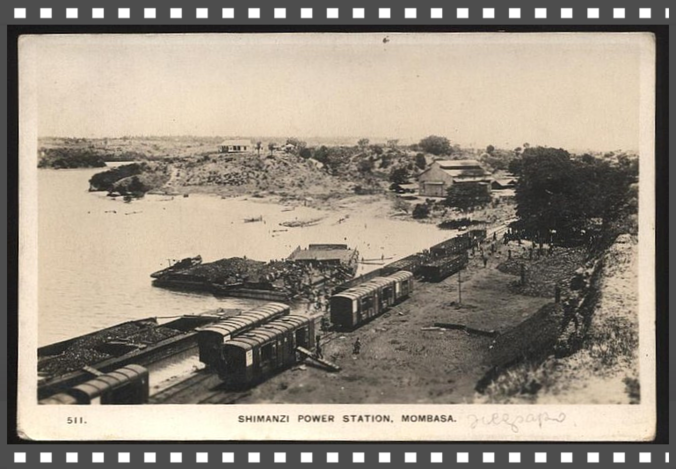
Shimanzi, Kipevu & Port Reitz
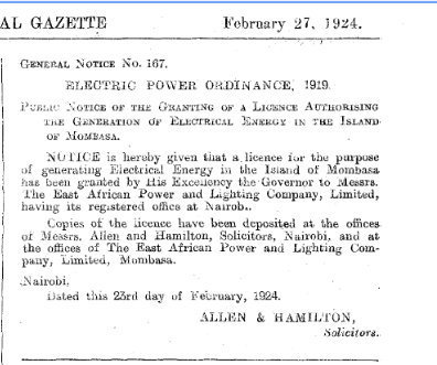
Accordingly to Mombasa’s history on Electricity narrated by Kenya Power “1875: Seyyied Bargash, the Sultan of Zanzibar, acquires a generator to light his palace and nearby streets.
1908: Harrali Esmailjee Jeevanjee, a wealthy merchant in Mombasa, acquires the generator and transfers it to the Mombasa Electric Power and Lighting Company. "
1922: The two utilities in Nairobi and Mombasa are merged under a new company incorporated as the East African Power and Lighting Company (EAP&L).
On 27th Feb 1924 an application in the Official Kenya Gazette that was made under Electric Power Ordinance 1919 an appropriate licence granted to East African Power and Lightening for generating
electrical energy, application made via Allen and Hamilton Solicitors.
Subsequently that allowed the introduction of Berth of Nos. 3,4, 5 and the Shimanzi Oil Terminal (SOT) 1929 – 1931.
In 1929, berth nos. 3 and 4 were completed and were supported by ordinary transit sheds. In 1931, no. 5 and the Shimanzi Oil Terminal (SOT) were completed. The SOT was to handle refined oil.
Kipevu spans towards Changamwe North/west and West ward towards Port Reitz, both situated on mainland of Mombasa.

Port Reitz, Mombasa
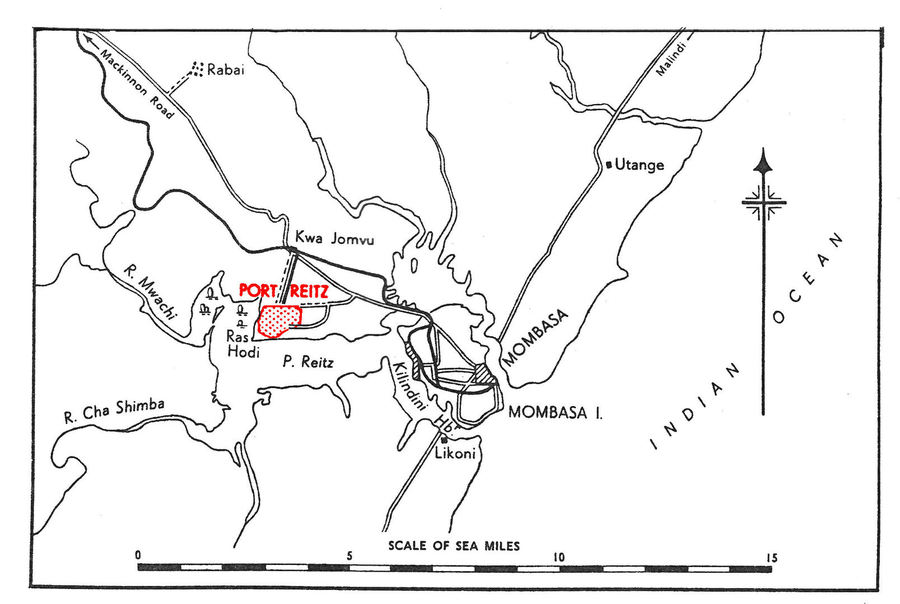
Mombasa: The “Island of war”…. Port Reitz
Situated on the Eastern coastline, bordering the Indian Ocean, Mombasa is Kenya’s second largest city and the top coastal destination. The city, originally known by
its Arabic name منبعثة Manbasa, was popular as ‘Kisiwa Cha Mvita’ Swahili for “Island of War”, due to the many changes in its ownership. Sitting on an island it is separated from the
mainland by two creeks Tudor and Port Reitz. Port Reitz has a District Hospital, one can fly from Mombasa Airport at Port Reitz, it also has a very large Industrial area…etc, so how did that area get
named Port Reitz?
Lieut Reitz is forgotten and left unheeded beneath a duka in Old Town. Some of you may recall that he accompanied- Capt. Owen when Leven and Barracouta set out from Woolwich in 1823 on an exploratory
and mapping expedition to the East African coast.
When the ships arrived at Mombasa the local inhabitants, who were tired of fighting with Seyyed Said, resolved to give up their country to the English. So they approached Capt. Owen.
This cautious officer remarked that if the people of Mombasa would desist from the slave trade he would transmit the proposal to the home Government. In the meantime he would hold Mombasa for them.
And so, Lieut. Reitz, a 22-years-old officer became the first British commandant of the Fort. His term was short, however, for he died three months later, Capt. Boteler records the
funeral:
The burial took place in what was the ruins of a Portuguese church. A grave seven feet in depth was dug near an immense piece of masonry, which alone indicated, where
the altar once stood.
The corpse decently arrayed in fine cambric, was conveyed to the church, followed by a procession of the first people of town. The funeral service was read and the body consigned to the earth with
military honours. A humble specimen of Arab masonry plastered over and washed marks the spot.”
Port Reitz was named after the lad. The old church stood where the Bohra Mosque now stands in Ndia Kuu. Zuru, Kenya & Edward Rodwell
HMS Leven… http://en.wikipedia.org/wiki/HMS_Leven_%281813%29
HMS Barracouta .. http://collections.rmg.co.uk/collections/objects/540856.html
Zuru Kenya


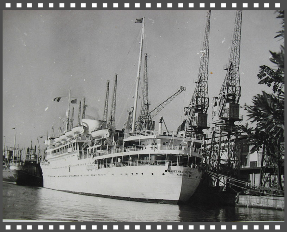


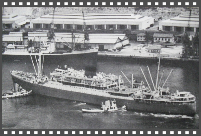

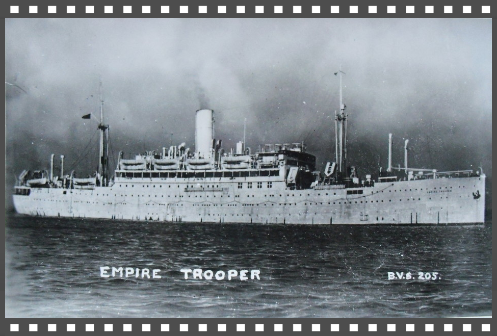
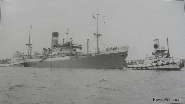
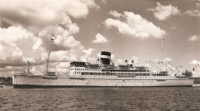
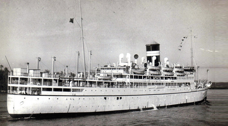
There was once a ship called SS Karanja
https://owaahh.com/there-was-once-a-ship-called-ss-karanja/
https://wesaidgotravel.com/kenya-to-india-memories-and-an-old-friend-from-the-s-s-karanja/
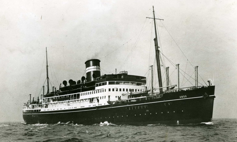
Voyages between Mombasa and Bombay – SS Khandalla and SS Amra
Click below, more on Old Port
 Click above
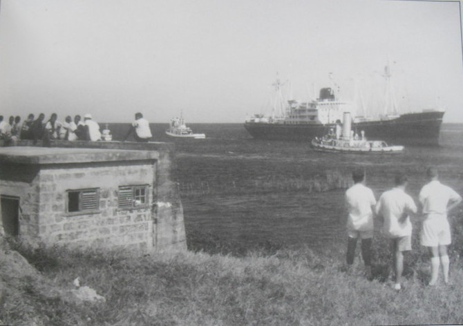
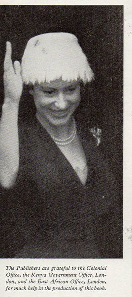
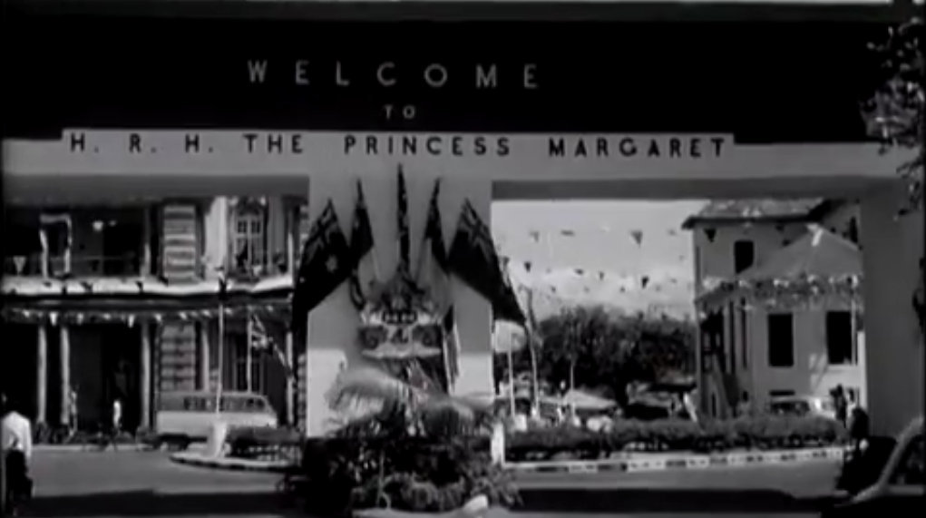
Princess Margaret’s Tour of East Africa
PRINCESS MARGARET’S SECOND COLONIAL TOUR
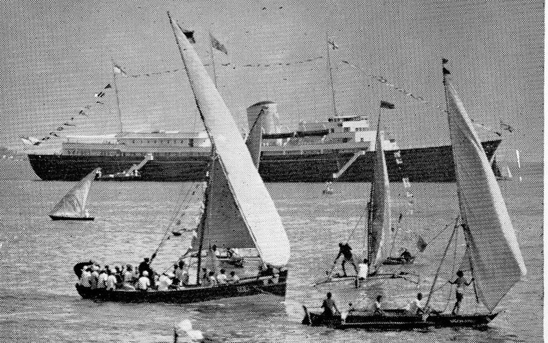
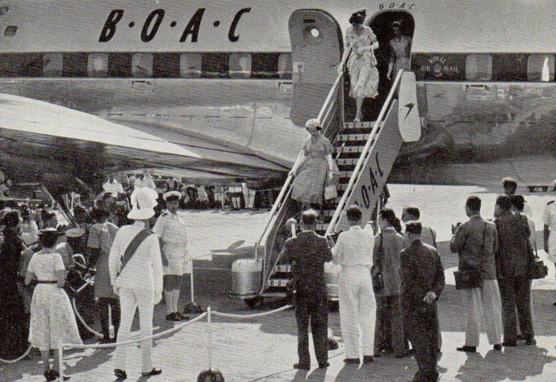
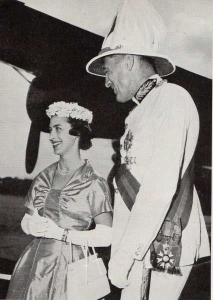
The map below (which is reproduced by kind permission of the Daily Telegraph) shows the route taken by Princess Margaret during her tour of East Africa and Mauritius. The outward and homeward journey was made in B.O.A.C.’s Argonaut airliner Ajax, G-ALHD, which between times also brought the Duke of Edinburgh to Mombasa at the beginning of his round-the-world tour. The royal yacht, Britannias which, because of the Suez Canal crisis, was sent via the Cape of Good Hope, awaited the Princess at Mombasa and was used for the 1,532- mile sea passage from Mombasa to Mauritius and for the 1,377-mile return journey to Zanzibar. The second photo shows the royal yacht dressed overall at Zanzibar soon after the Princess’s arrival there. For the relatively short overland flights in Tanganyika and Kenya Princess Margaret used a de Havilland Heron aircraft of the Queen’s flight.
THE PRINCESS ARRIVES IN MOMBASA
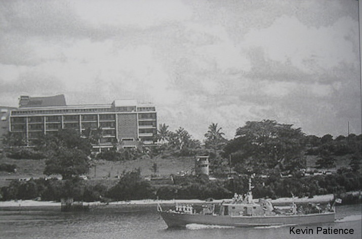
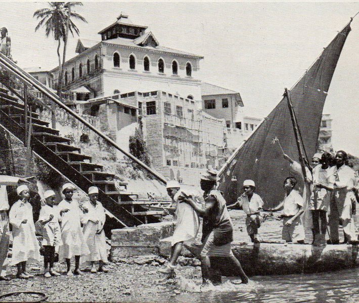
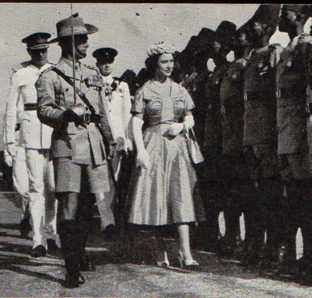
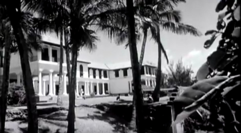
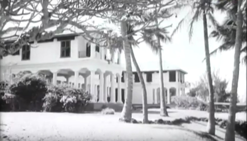
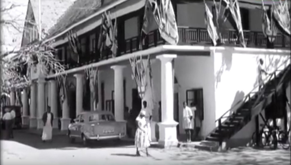
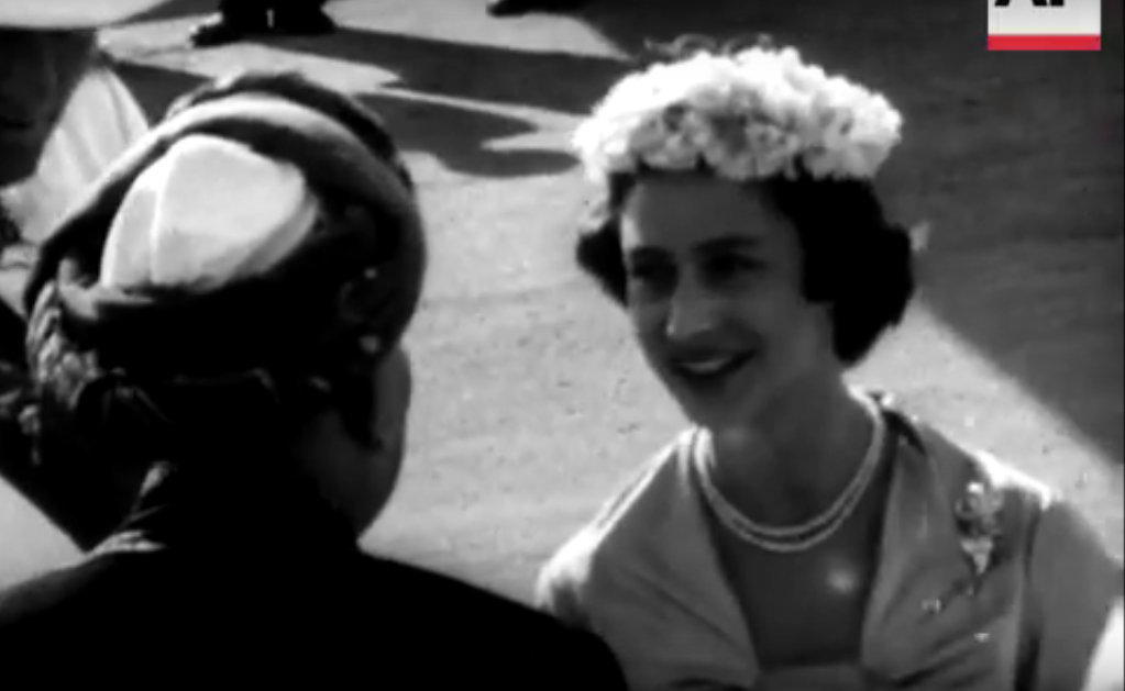
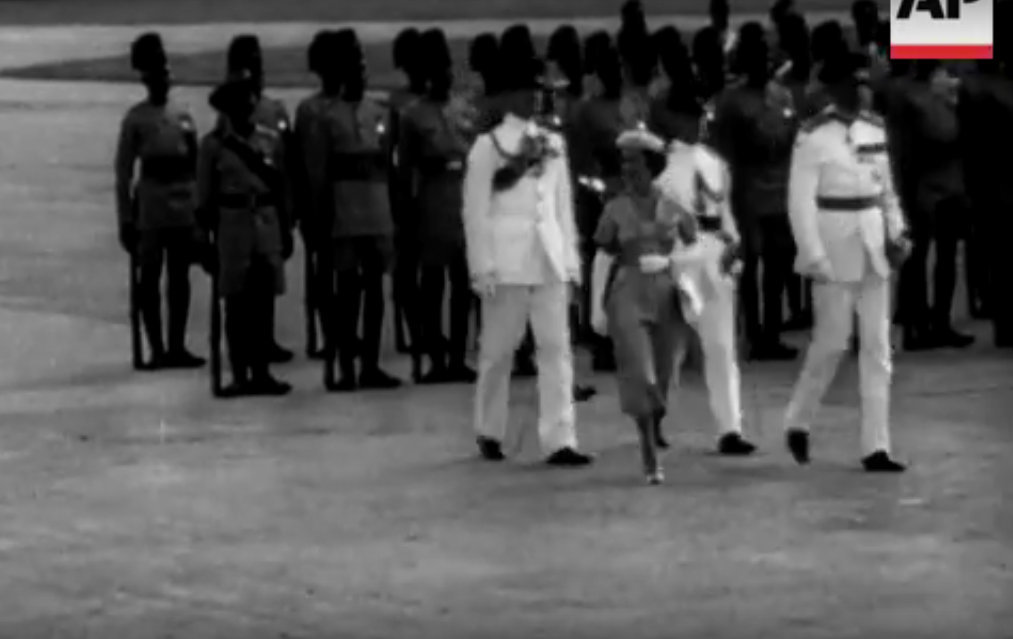
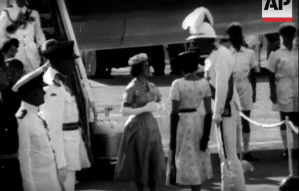
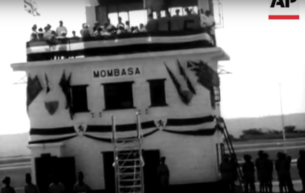
At 9 a.m. on 21st September, 1956, Princess Margaret accompanied by the Queen Mother drove into London Airport to begin her second Colonial tour. Formalities and good-byes were short. The Princess took leave of her mother in the aircraft —a gleaming blue and silver B.O.A.C. Argonaut. Then she waved gaily from the doorway and at 9.20 a.m. was airborne and on her way to Africa. After refuelling at Gibraltar and Kano the Argonaut touched down at Port Reitz Airport, Mombasa, at 4 p.m. local time the following day. The Governor of Kenya, Sir Evelyn Baring, and Lady Mary Baring were there to greet Her Royal Highness. On the processional route 60,000 other subjects of Her Majesty had gathered— the population of the ancient port where the Queen of Sheba once landed was doubled for the day. They came by rail, on foot, by bicycle, by car, by camel and by donkey and some—like the Arab boys seen below—in dug-out boats.
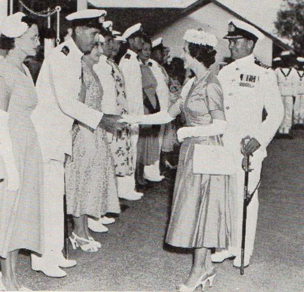
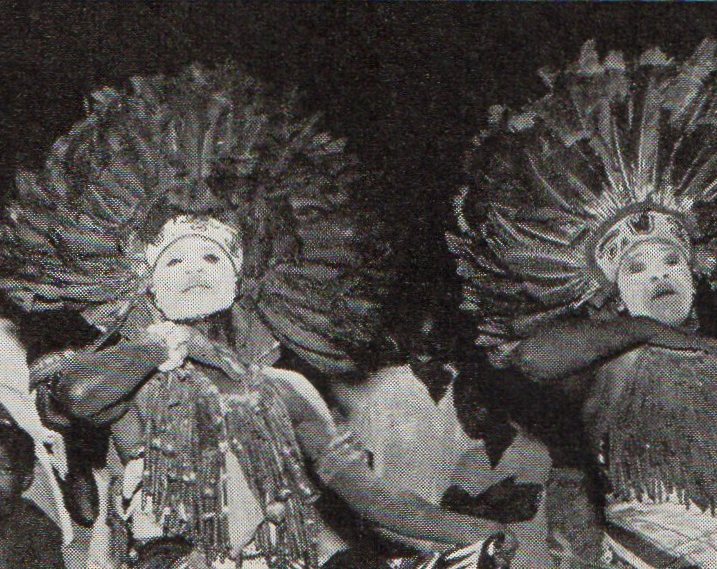
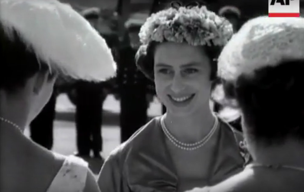
The Princess stepped out of her ’plane as fresh as the proverbial daisy and much more lovely. She inspected a Guard of Honour of the King’s African Rifles, all six-foot-sixer’s and as straight as ram-rods. Then she drove to Government House. On the processional route she passed an Arab bazaar and saw black veiled purdah women. She passed an Indian section, the women in brilliant silk saris, the men in equally colourful turbans. She acknowledged the waves of a bevy of Kikuyu girls, pretty in Western print dresses but with shaven heads. She acknowledged also the dignified greetings of African officials, their pin-stripe trousers contrasting with the billowing white robes of Arab sheiks. Thousands of flag-waving children had pride of place. Their uninhibited yells encouraged the more shy adults to shed their natural reserve. The result was tremendous. After tea Her Royal Highness went to the Naval Base and met the Commonwealth’s youngest maritime force—the Royal East African Navy. Its 200 ratings are drawn from many tribes in Kenya, Tanganyika, Uganda and Zanzibar, and with a few British officers and petty officers it operates two small vessels. At sundown the Princess boarded Britannia. Later on board, in the velvet darkness of an African night she watched a grand firework display. On shore the celebrations included dancing. Hundreds of tribesmen, like the two seen on this page, cavorted themselves to exhaustion. Jambo ! Jambo ! Jambo ! was the cry everywhere, which in Swahili, means “ Good-day and welcome.” Saturday, 22nd September, 1956, really was a good day for Mombasa.
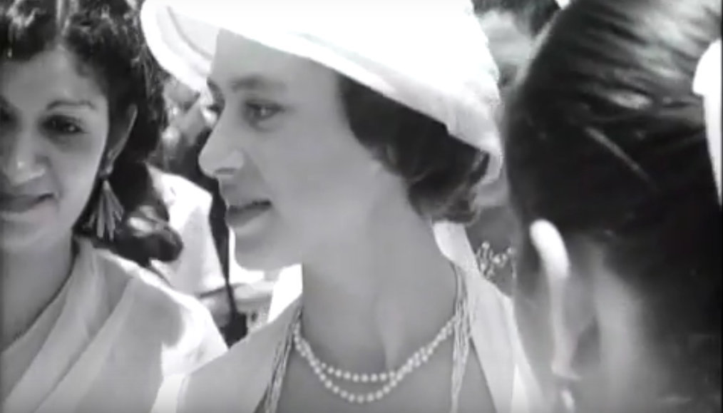
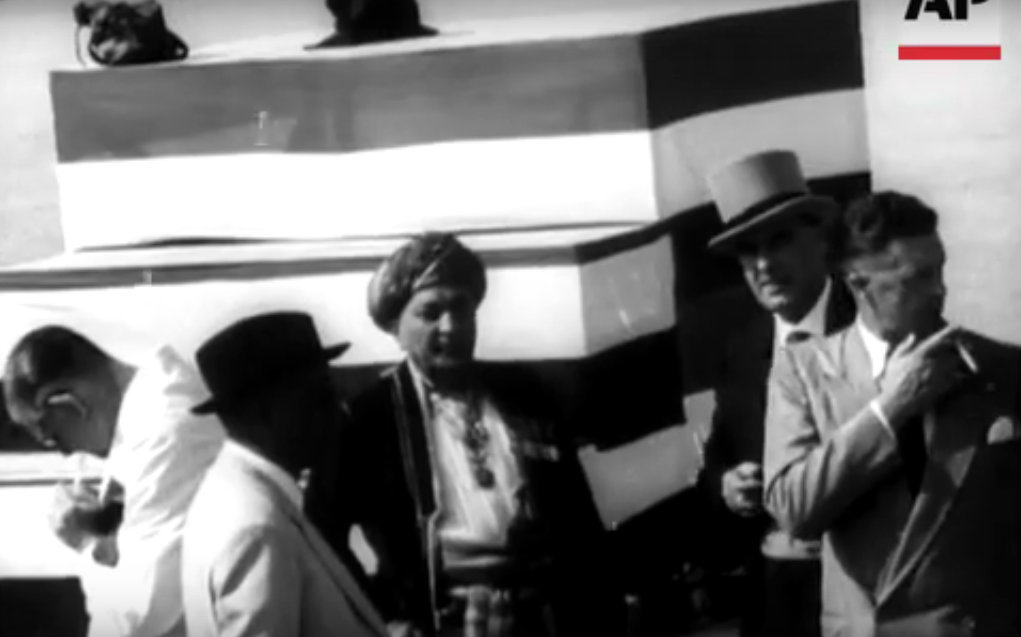
66 VERILY WE HAVE GIVEN 1
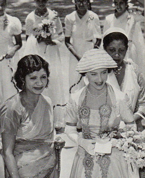
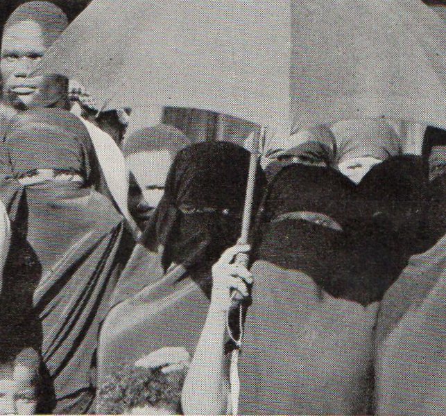
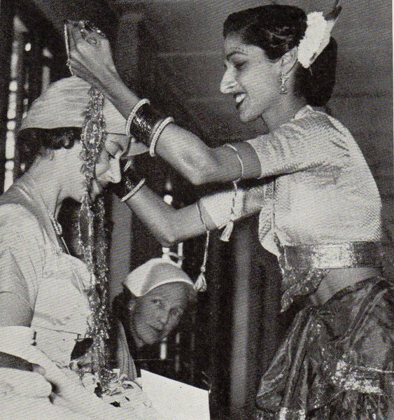
Ten hours of almost unbroken activity faced Princess Margaret when she came ashore at Mombasa from the Royal yacht at 10 a.m., Sunday, 23rd September. There were presentations, then Morning Service at Mombasa Cathedral. At 11.35 a.m. the Princess entered the great Diamond Jubilee Hall to meet Asian and Arab ladies. Dancing girls performed a dance of welcome. Then their leader glided gracefully to the dais and placed an ornate gold chain with garlands of intricately fashioned gold flowers around Princess Margaret’s neck. Later she was photographed with some of her 700 hosts. After luncheon she went to Sheik Mbarak Ali Hinawy’s house in the old slave port. The Sheik is Liwali or chief adviser on Arab affairs to the Kenya Government. Here she stepped across the threshold of the zenana. No men (and that applied to the Princess’s detective) were admitted. In a darkened room, heavy with incense, veiled women sprinkled perfumes on her handkerchief and in a drawing room the Sheik’s ladies removed their yashmaks and offered Her Royal Highness ceremonial presents of dates. From the cool seclusion of a purdah household the Princess drove to the Municipal stadium where 20,000 children—Indian, Arab, African and European—waited with mounting excitement. The grand finale of this engagement was an announcement : “ Her Royal Highness has asked that you should be given a holiday tomorrow. ...” There was pandemonium. At Government House that evening the Liwali presented Arab notables and gave the Princess a repli¬ca of a pair of doors on which is carved an inscription from the Koran, 44 Verily we have given thee a perfect victory.” At 8 p.m. that day, Princess Margaret said goodbye to Mombasa and sailed for Mauritius in Britannia.


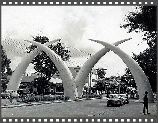
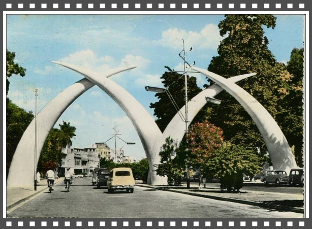
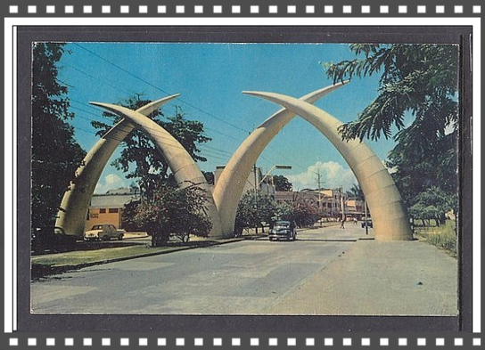
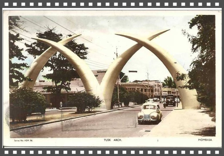
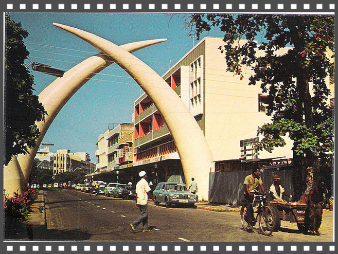
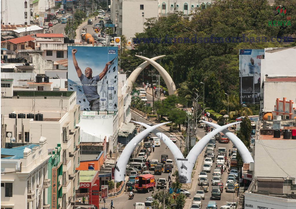
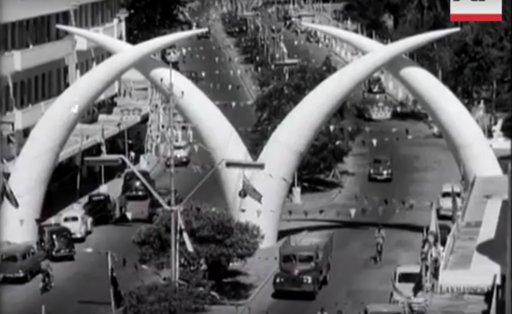
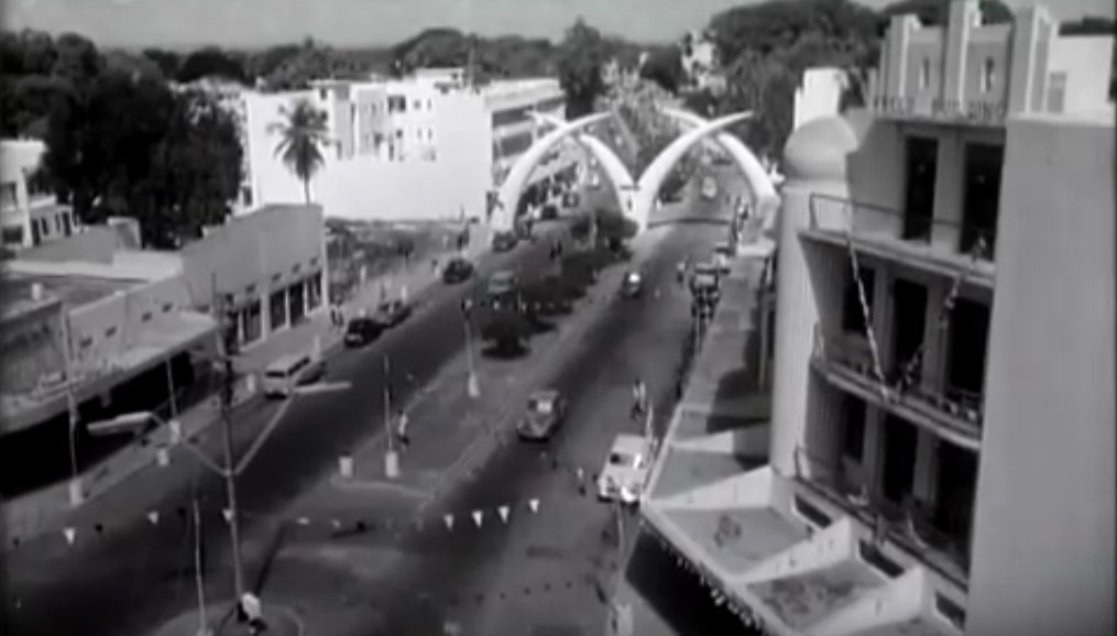
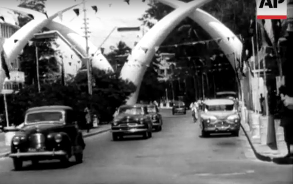
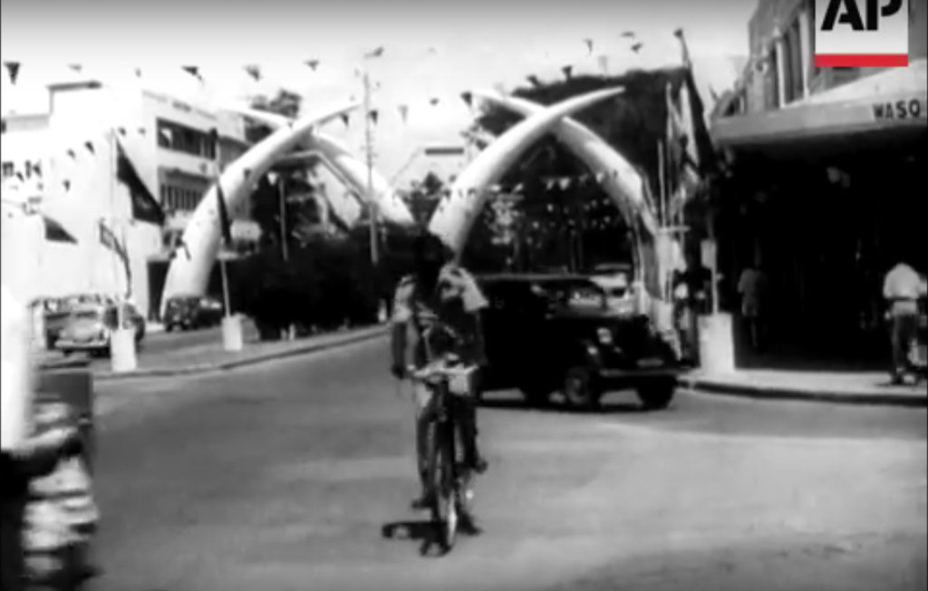
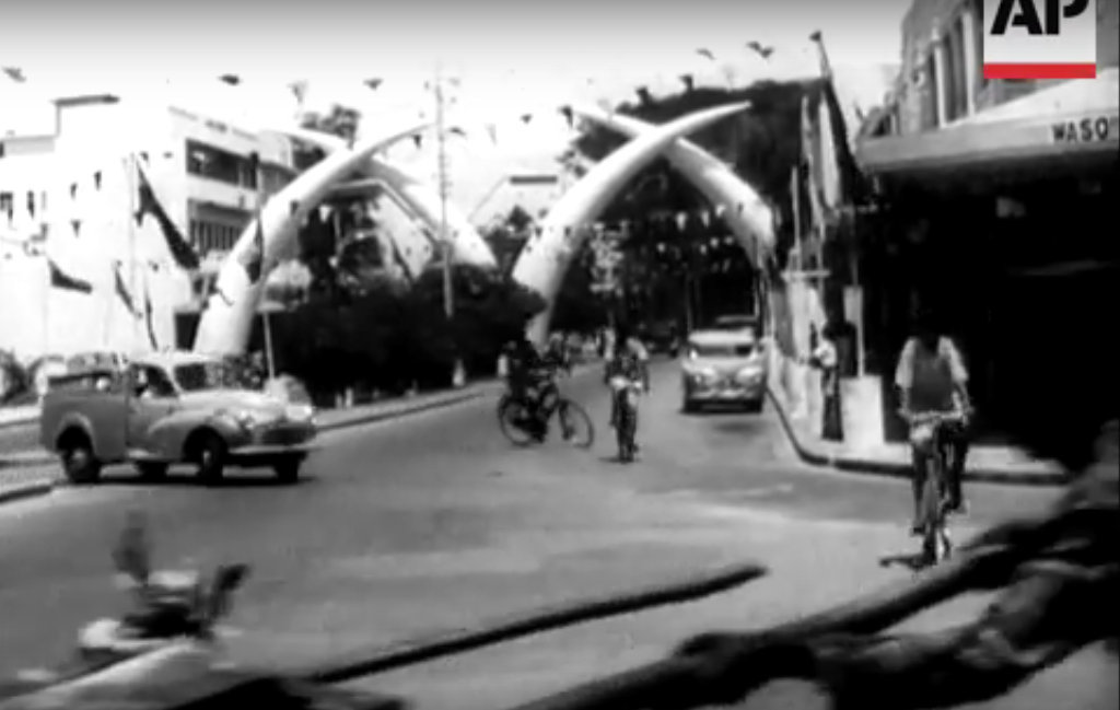
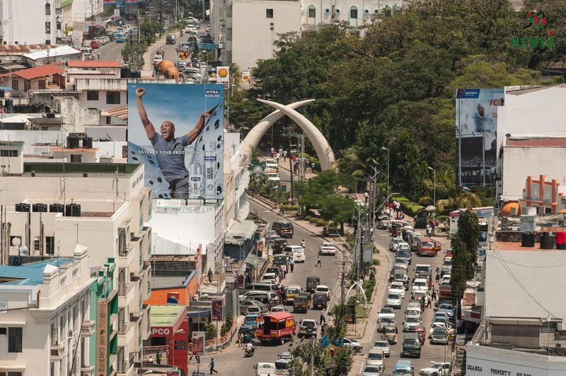
Elephant Tusks
Click on Photo below to Enlarge.


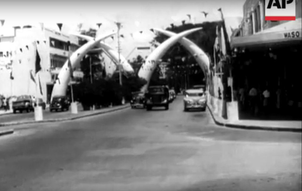

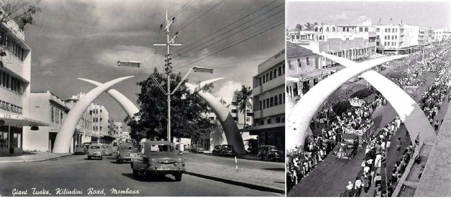
Right side photo……HER PRINCESS ARRIVES IN MOMBASA
At 9 a.m. on 21st September, 1956, Princess Margaret accompanied by the Queen Mother drove into London Airport to begin her second Colonial tour. Formalities and good-byes were short. The Princess
took leave of her mother in the aircraft —a gleaming blue and silver B.O.A.C. Argonaut. Then she waved gaily from the doorway and at 9.20 a.m. was airborne and on her way to Africa. After refuelling
at Gibraltar and Kano the Argonaut touched down at Port Reitz Airport, Mombasa, at 4 p.m. local time the following day. The Governor of Kenya, Sir Evelyn Baring, and Lady Mary Baring were there to
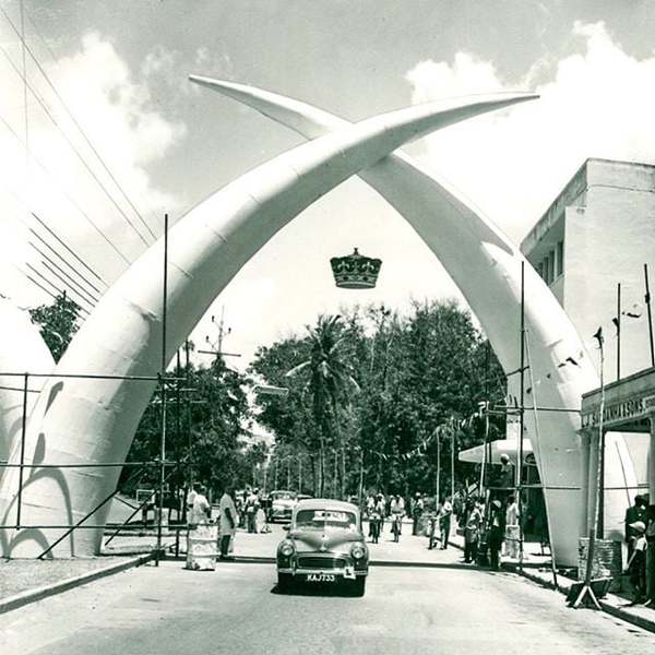
greet Her Royal Highness. Coronet hanging between the tusks marks a Royal visit.
If we look carefully at these photos, one will without a doubt notice two significant points that are totally different to the current positioning of the Tusks location.
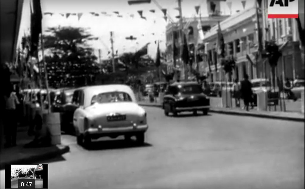
a) Ford Consul/Zephyr/Zodiac Mk1 (1950 - 1956) KYZ 460… K series were introduced in Kenya in 1950….
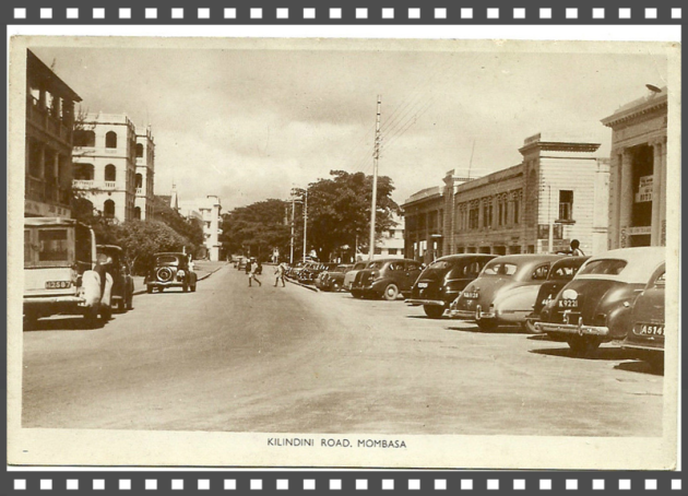
Ford car is seen manoeuvring a right bend before embarking on to a Straight on Kilindini Road going straight on towards Salim Rd. The current location of the Tusks opposite the Uhuru Garden has no
bend in front of it.
b) Secondly, the first Tusk looking on, on both the photos, the left Tusk by the pavement is overlapping, the positioning of it is in front of the other and that is very significant, because all
current Tusks location photos show that they are behind, that would mean they were moved and re-positioned to its current location and state (different to these).It is also thought that these were
the original Tusks that were made out of Canvas and wood.
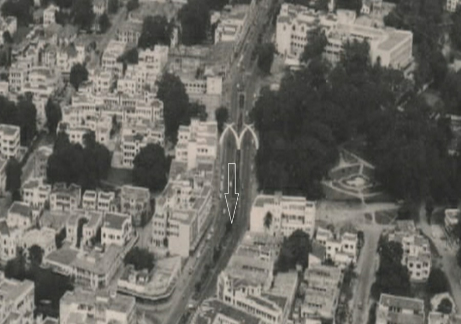
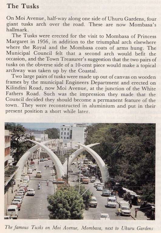
It is thought that wooden and canvas Tusks were first built in 1952 to commemorate the visit of then Princess Elizabeth II and Her Husband Prince Philip. However the Visit to Mombasa was cancelled owing to the sudden demise of Princess Elizabeth’s father King George VI in England whilst the family was in Nyeri residing at the famous treetops hotel. They were possibly up again at a location shown (arrowed) located by White Fathers Road and they were later on taken down after the Royal visit of the 22nd September, 1956, Princess Margaret’s visit, to the now current location and are made of Aluminium positioned near Uhuru Gardens.

From the book called Mombasa and the Kenya Coast by J.H.A Jewell (page 34)
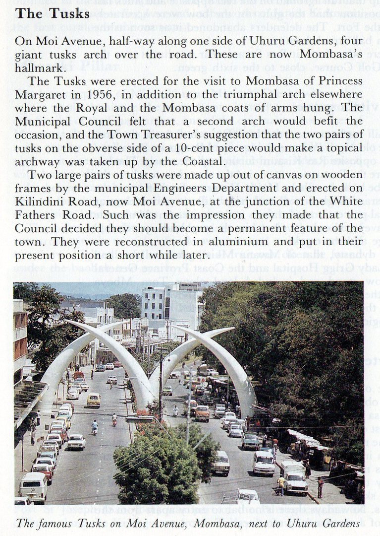
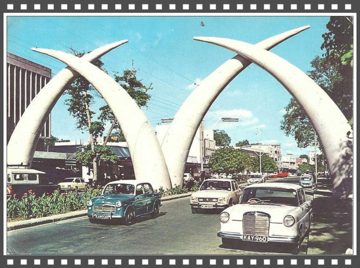
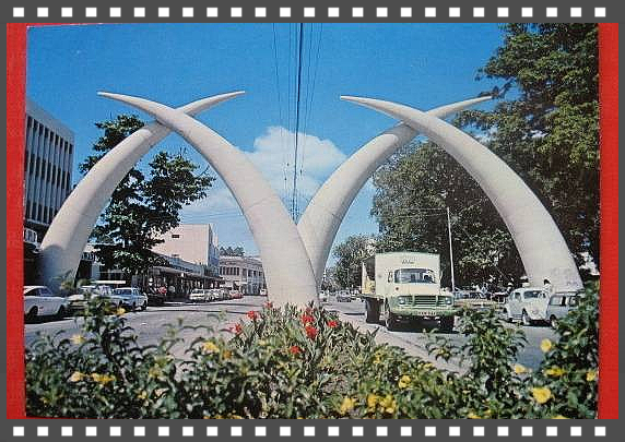
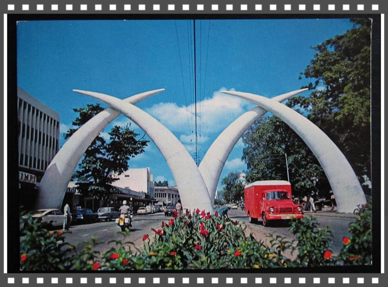
Of The Tusks
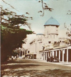
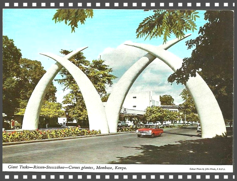
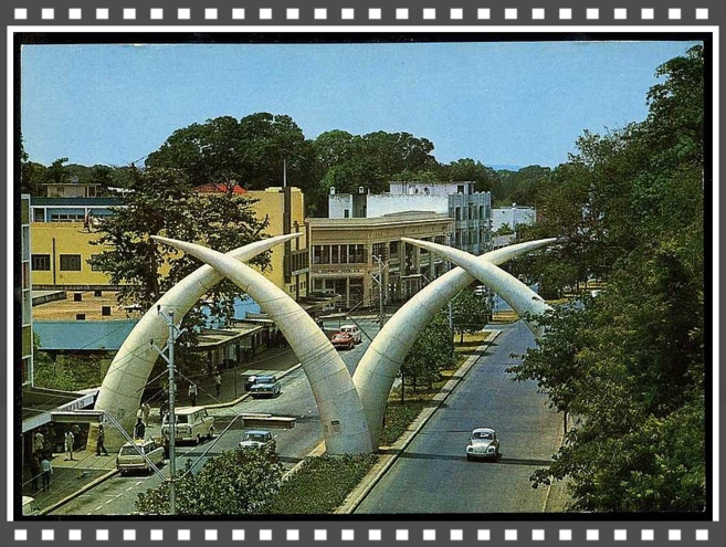
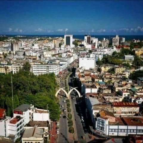
On Moi Avenue, half-way along one side of Uhuru Gardens, four giant tusks arch over the road. These are now Mombasa’s hallmark.
The visit to Mombasa
of Princess Margaret in 1956, in addition to the triumphal arch elsewhere where the Royal and the Mombasa coats of arms hung.
The Tusks were first built in 1952 to commemorate the visit of then Princess Elizabeth II and Her Husband Prince Philip. However the Visit to Mombasa was cancelled owing to the sudden demise of
Princess Elizabeth’s father King George VI in England whilst the family was in Nyeri residing at the famous treetops hotel.
The Municipal Council later felt that a second arch would befit the occasion, and the Town Treasurer’s suggestion that the two pairs of tusks on the obverse side of a 10-cent piece would make a topical archway was taken up by the Coastal.
Initially the two large pairs of tusks were made up out of canvas on wooden frames by the municipal Engineers Department and erected on Kilindini Road, now Moi Avenue, at the junction of the White Fathers Road. Such was the impression they made that the Council decided they should become a permanent feature of the town.
Most people in Mombasa knew him as Tug, Richard Ambrose Wilson who was commonly known as Dick (a nickname for Richard OR Tug which is a nickname for anyone called Wilson) is thought to be the person who came up with this historic idea in the making. (Information kindly provided by his daughter Ms Sandra Collins currently of Johannesburg, Gauteng, South Africa, who we are thankful to).
They were re-constructed after tendered out by the Municipal, to be
built in aluminium and put in their present position a short while later in 1956, this was built to the highest quality by a renowned local family called Haji Suleman Haji Ladha and Sons of Mombasa,
what an accomplishment, built with quality in mind and also to last. What an achievement!
Credit and thanking Ms Gulshan
Hussein
Mombasa Welcomes The Princess 1956
http://www.britishpathe.com/video/mombasa-welcomes-the-princess
http://en.wikipedia.org/wiki/Moi_Avenue_%28Mombasa%29
White Father’s Road, Mnazi Moja, Mombasa

News
 Click above for Kenya
 Click above for Uganda.
 Click above for Tanganyika.
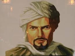 Ibn Battutah ( click for more)
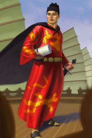 Click for more on Zeng He
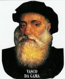 Click for more on Vasco Da Gama
 Zeng He Routes
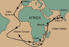 Vasco Da Gama Routes
 Click above
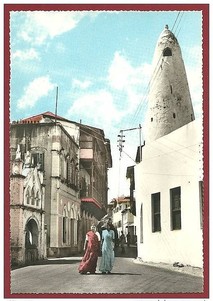 Click on Photo, visting Mombasa
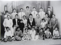 Typical Indian Family & Friends
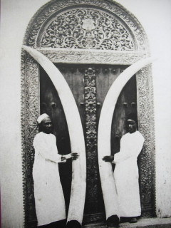
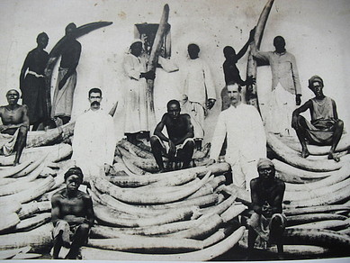 Ivory was major trade of Indians/Europeans/Arabs in E/A
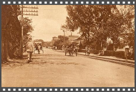
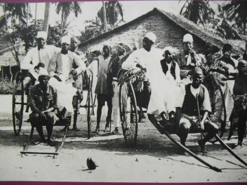 Early Rickshaw
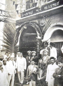 Ithnasheri Guest house 1926 opening (Click on photo)
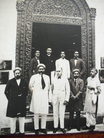 Karimjee Business deal 1924
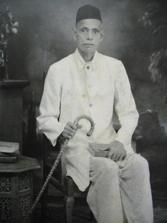 Businessman Sunderji Nanji Damodar
 Click above