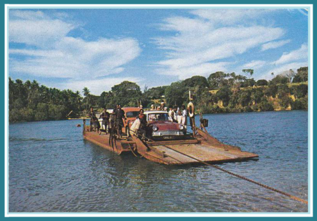
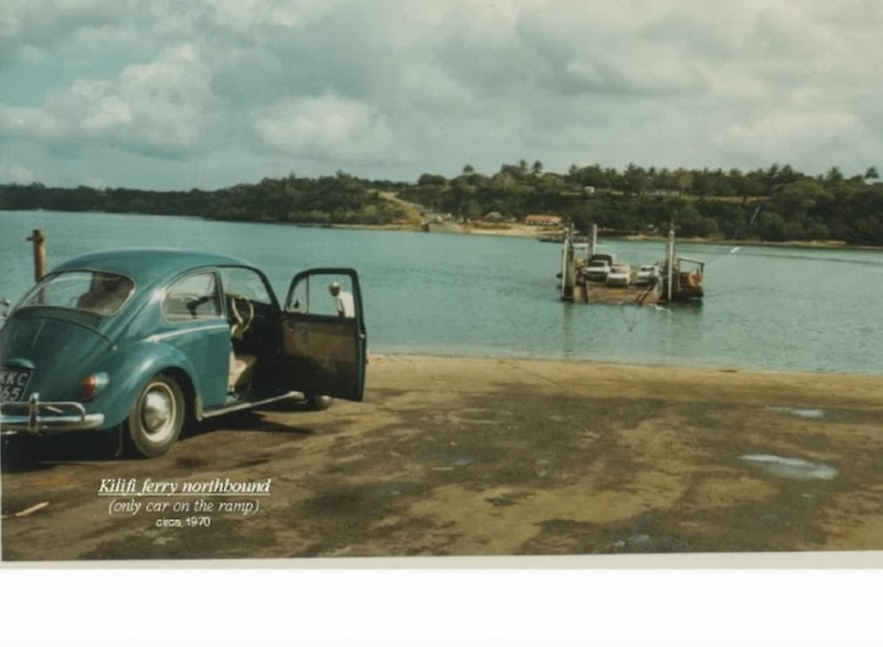
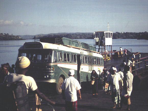
Kisauni Ferry
In the earlier days canoes and boats were used to and from the Island of Mombasa to the main land and vice-versa.
Makupa to the North-West between Kipevu and Port Tudor was one of the main routes to the mainland Changamwe, “Kupa” is the word used to describe the movement of the tide out to sea. Ebbing of the
tide. This point is the shallowest place anywhere around the Island. During low tide one could walk across easily and cross over to and from the mainland to the island.
Bridge has been built across since.
Mtongwe to the West of the Island was another outlet route via boats or canoes to and from the mainland Mtongwe and back, later on we had the Mtongwe ferry operating services in that area around
Kilindini but this process ceased.
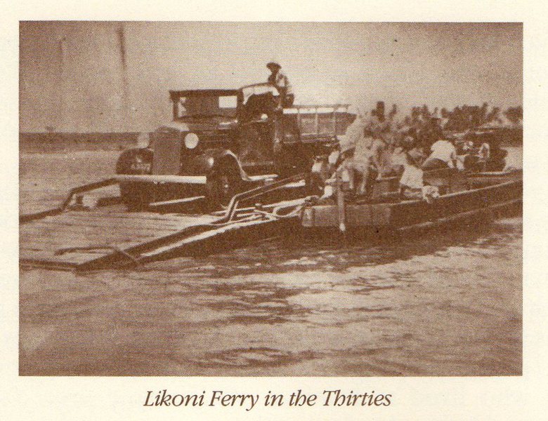
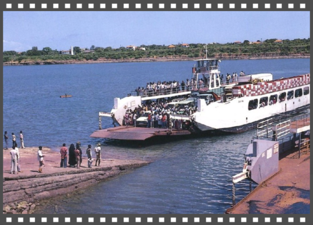
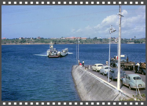
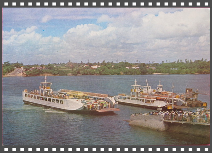
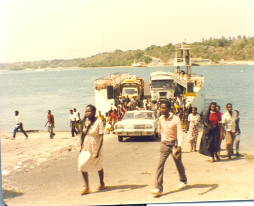
Likoni Ferry to and from the Island was yet another outlet route via boats or canoes to and from the mainland Likoni, it is located in the South-West part of the Island. Ferry services at
Likoni have been around since 1937 and is still in service to this very day.
Mombasa became the capital of the Protectorate of Kenya, sometime between 1887 and around 1906. We have since seen
Mombasa Harbour, Mombasa old port, which handled the maritime traffic of the day, had no capacity to serve the influx of railway builders, soldiers of fortune, merchants of trade, Christian
missionaries/explorers and the rest of the impedimenta introduced by the British Empire.
The growth of present day Kilindini Harbour started in 1896 with one jetty, following the arrival of the steamship "S.S. Ethiopia" carrying material for the building of the Uganda Railway.
A new port was needed. But since a port cannot operate without the hinterland transport infrastructure, a decision was made by the British colonialists to build a railway line. The British also
wanted to protect their strategic interests in Uganda from the Germans. So on 11 December 1895, Mr George Whitehouse, a British engineer, who had previously been involved in the construction of
railways in England, South Africa, India and South America arrived in Mombasa to oversee the building of the Uganda Railway.
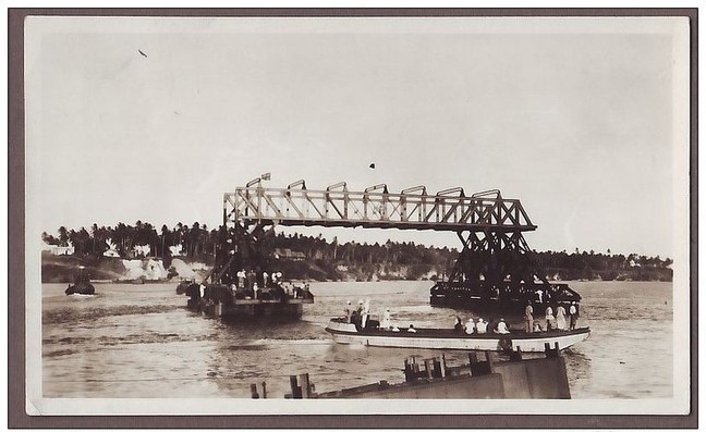
Agreement 9th Oct 1929, Nyali Ltd and the government of Kenya colony and Protectorate was made, a bridge linked the Mzizima district of Mombasa to Nyali, and
was built in 1931.
It is almost inconceivable that 89 years ago, a huge crowd stood on both sides of the Nyali creek, to witness the then colonial governor Joseph Byrne officially commission the bridge.
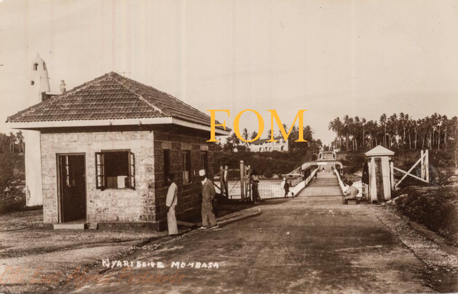
If anybody is old enough, that possibly knew Mombasa well enough, they too would know that there was a ferry operating between the Island and Kisauni in the North East, Old Salim Road to the North
took us onto the end of the Island and ferry services to mainland Kisauni, but I am afraid I have not come across anyone that can remember.
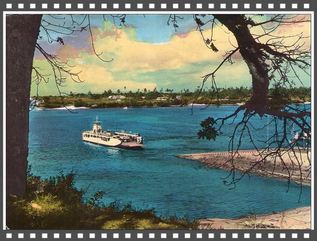
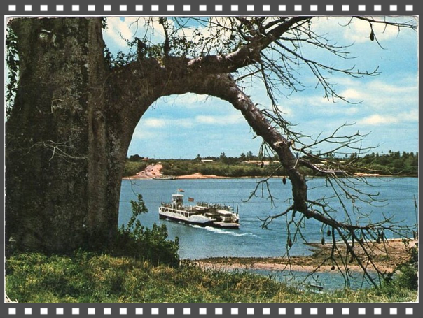
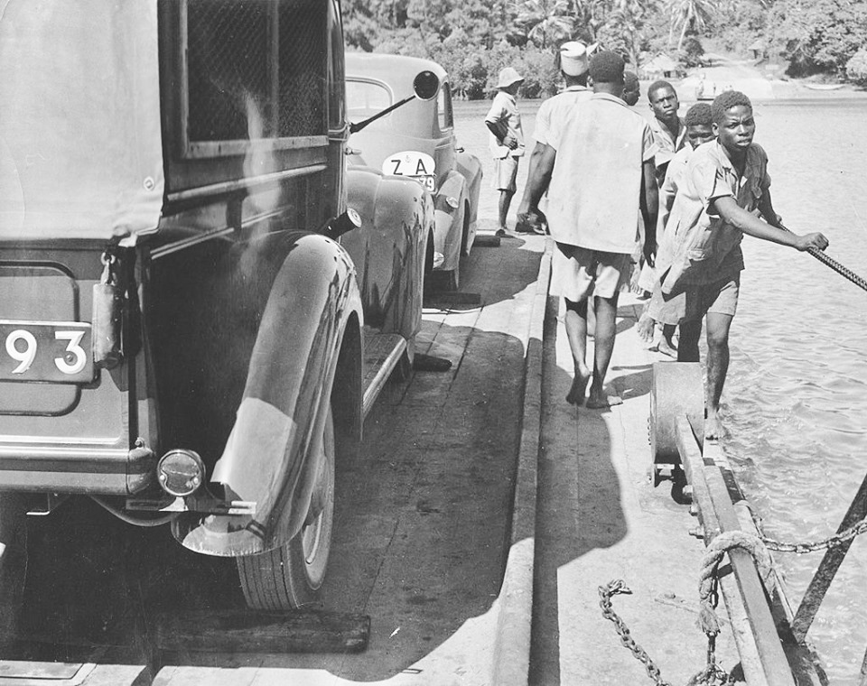
Kisauni Ferry to and from the Island was in operation well before Nyali bridge came into its existence.
Here are authentic historical pictorial artefacts that point us to Mombasa’s authentic history that unfolds, what was actually used well before 1931 when the Floating Pontoon Bridge was first
introduced through the idea of constructing a bridge to connect Mombasa to Nyali and beyond that had been conceived in 1926.


Crossings to and from the Island of Mombasa
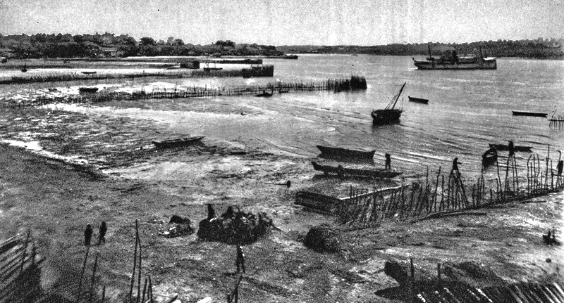
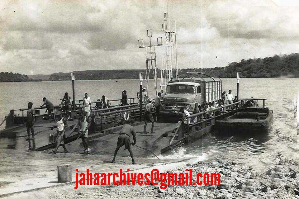
It is believed canoes were used as ferry services to ferry people and loads to cross over from Mombasa to mainland or vice versa.
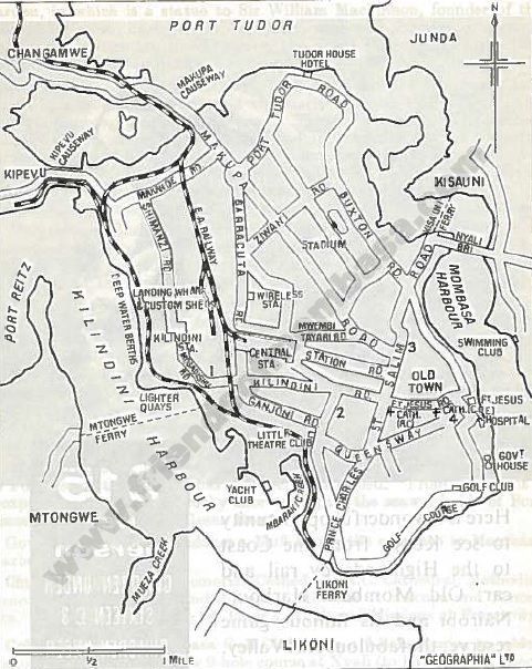
Not much is known about Mtongwe Ferry operating to the South Coast from Mombasa, that was located between Kilindini and Likoni around Baraki area...
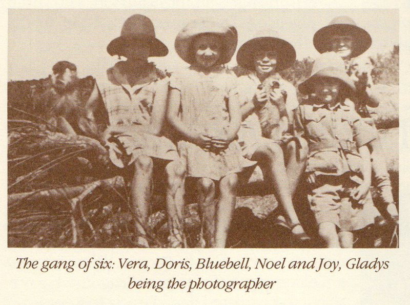
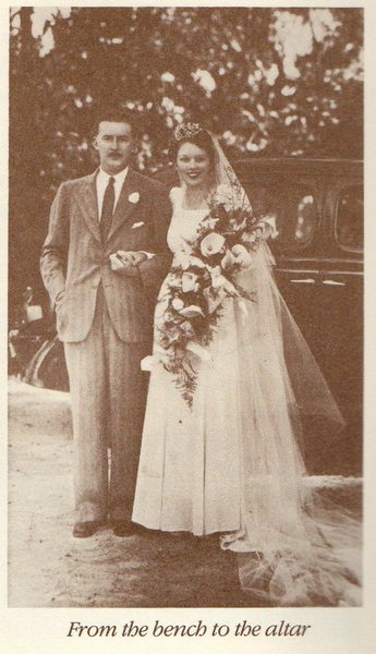
Likoni Model Dairies
by Doris Morgan
In the early 1930’s Bowring family moved to the Likoni area over to the South Coast of Mombasa, there stood a beautiful Arab’s house owned by Mohamedali just above the present ferry ramp.
In those days there was no security required; doors needed no keys, windows no bars.
Another gabled house that still stands above present Likoni ferry ramp was Manager’s house of the East African Estates but is now rather hidden from view.
Likoni Model Dairies was started by Russel Douglas and Bowring family, at that time the only cattle at the coast providing milk for the island were in dairies on the island and all were stall fed from the moment they arrived at the Coast until they died. They were poorly maintained animals hooves grew as large as a soup plate through constant standing in one place.
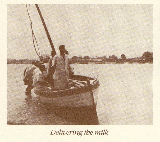
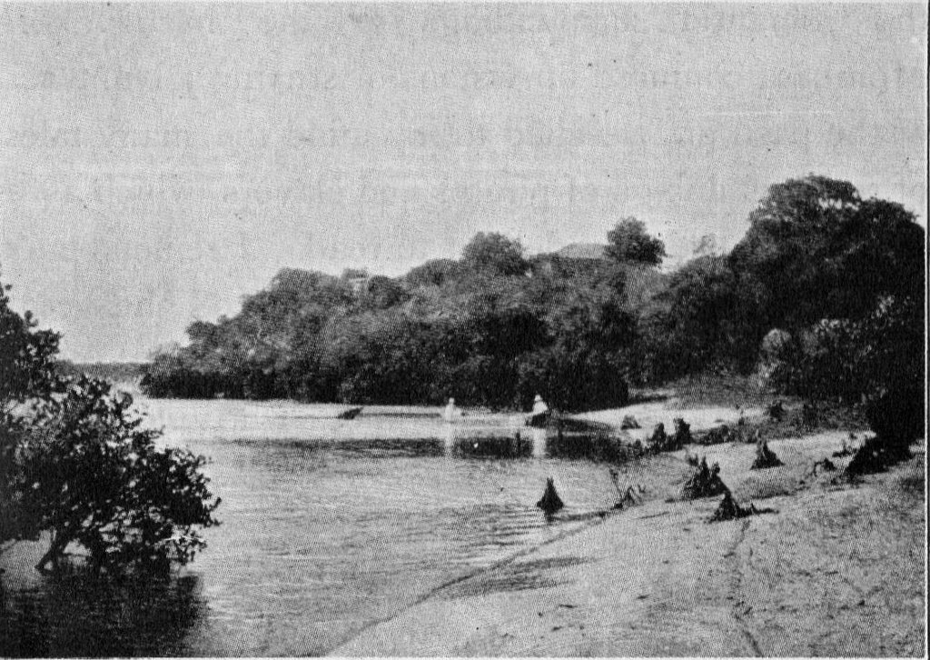
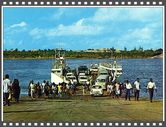
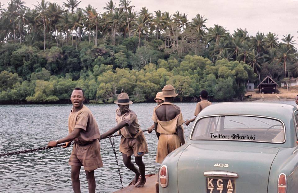
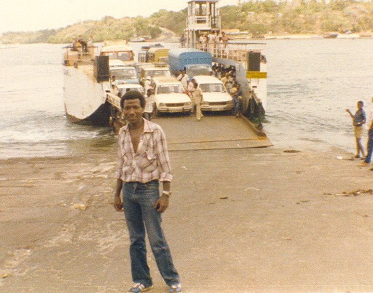
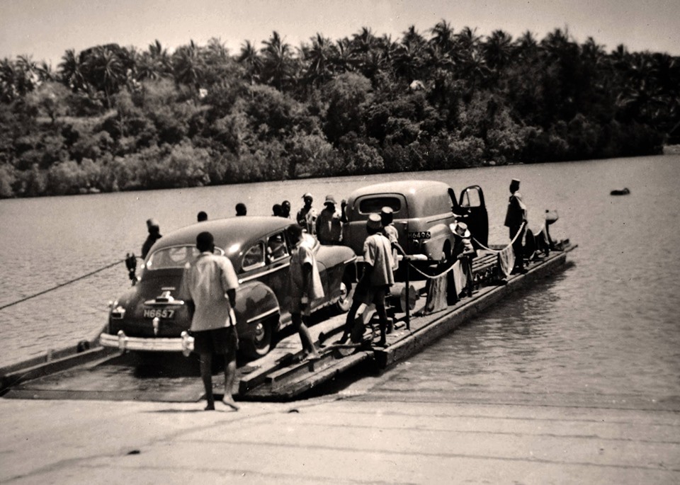
Cows arrived on train into Mombasa they had to be taken over to the mainland on the old pontoon ferry. It does not take much stretch of the imagination to visualize the scene as the herd of cattle were driven down the ramp on to the ferry.
Advertising gimmicks of Likoni Model Dairies was “everything under European Supervision” which meant member of the family had to be present at milking times.
Bus operated from Mombasa town to Likoni and back again, there was no ferry before 6 am and after 6pm, it operated between 6am to 6pm…milk was delivered to customers door step, by delivery
men in the early hrs by boat when ferry not in use.
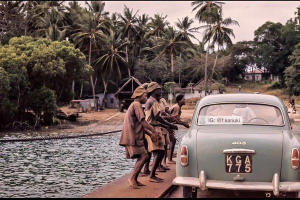
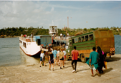
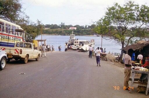
Likoni Ferry at that time was a two car ferry and at times broke down and often wandered out to sea.
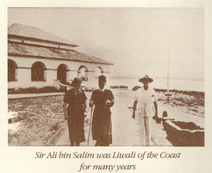
With the Bowring family living on the mainland, also lived Sir Ali Bin Salim who lived at Peleleza was close to the family, Salim Road was named after him and was a genourous individual, who helped many, by also giving away land in Mombasa and surrounding area for devolopments as well as sports facilities.
Although it has been said that the Likoni ferry services started around 1937 it is clear from Ms Doris Morgan's accounts that Likoni Ferry was already in operation when their family moved to Likoni area in 1931.
There are seven operating ferries. MV Mvita and MV Pwani were bought in 1969 and 1974, respectively; MV Nyayo, MV Harambee, and MV Kilindini were bought second hand in 1990. MV Kwale and MV Likoni were acquired in June 2010. MV Jambo was purchased from Türkiye in 2020.[2]
In 2010, Harambee, Nyayo, and Kilindini were deregistered from Lloyd's Register for being unseaworthy.[3] As late as May 2011, MV Nyayo was in still in use as
the relief ferry.
The Dongo Kundu bypass is planned to ease the congested ferry by connecting . The road would run from Diani to Miritini, bypassing Mombasa itself.[4]
A direct bridge or tunnel from Likoni to Mombasa Island had also been proposed, but the high cost of building them has made these options unlikely.[5]
In 2018, the United States Department of State cautioned travellers against using the ferry due to safety concerns.[6]


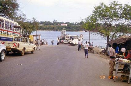
Ferry services at Likoni - Kenya have been around since 1937, and have played a pivotal role in linking the island to the mainland south of Mombasa, in effect offering the one and only infrastructural lifeline between the two areas. It is therefore the backbone of all the communications, and economic development. Unlike the northern side of Mombasa that is linked by bridges at Nyali, Mtwapa Kilifi and Sabaki the south coast depends solely on the ferries.
Ferry services at Likoni Mombasa started in 1937. The ferries have remained the one and only link to the south coast. The operations are situated on the gateway to the port of Mombasa. The link is important not only to the local users but to those heading to Tanzania and beyond.
The ferries at Likoni were initially ran by Kenya Bus Services Ltd, on a franchise arrangement with the Municipal Council of Mombasa. The bus company also operated a network of buses around town and in Nairobi.
The earlier operations were done using pontoons driven by motor boats. It was not until 1957 that the era of modern ferries surfaced.
The company continued operating for about 32 years until 1989 when it decided to pull out. It is then that the Government of Kenya decided to take over the operations of the ferries.
The Government therefore bought all the ferry crafts including Pwani, Mvita, St. Michael, Pombo and Mtongwe 1 at a price of Ksh 10.5m. The staff was similarly retained at their existing terms and conditions of service.
The government then asked Kenya Ports Authority to run the services on its behalf. Kenya Ports Authority on their part changed one of its subsidiary company's Bunty Estates Ltd to Kenya Ferry Services Ltd and commenced operations on 1st November 1989.
In 1990 the government bought four new ferries namely Mv's Nyayo, Harambee, Kilindini and Mtongwe 2 at a cost of Shs 376 million to supplement the existing fleet. Through financial assistance by way of advances from Kenya Ports Authority and the Exchequer, the company was able to sustain its operations during its infancy.
In 1998 the government formalized the ownership of the company through a National Assembly Sessional Paper No.3 of the same year, by transforming the contributions of both the government and Kenya Ports Authority into equity. Share capital was thus increased from Shs.2 million to Shs 500 million. The company is now owned 80% by the government and 20% by Kenya Ports Authority.
Credit to Hon Sheila Sayo Kahavidza for all photos below:


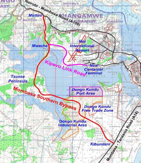
Credit and thanks to Ms Dorothy Melichar for all the photos and details to the new development at Construction of Dongo Kundu Bypass, the much discussed connection between the Island and the Southcoast…


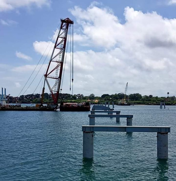

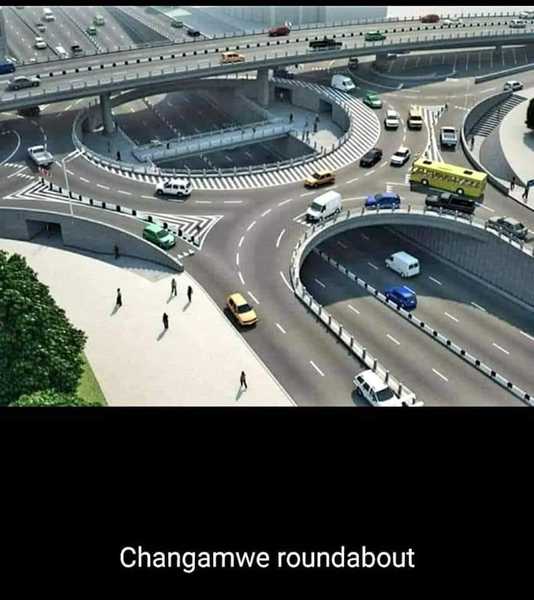
Construction of Dongo Kundu Bypass
Dongo Kudu Bypass, at Bonje, Miritini area in Mombasa , 11.4 km dual carriage way (Bypass) that started its construction in 2016 had completed its first phase in 2018 and was complete and open, it ends at the second terminal at Mombasa at a cargo handling facilities. This includes the access road of 1.3km at Moi International Airport (Port Reitz). Facilities also includes for commuters from Mombasa to Kwale and vice-versa ( that apparently is a relief for the Likoni Ferry terminal).
Phase 2 and 3 are yet to be complete…It was supposed to start in July 2018..8.9km stretch from Mwache to Mteza to the erected bridges and a 6.9km to Kibondani eventually connecting the road to Lunga Lunga Highway in Kwale
Upcoming Mombasa Northern Bypass
Bonje, Miritini also connects another 13km Bypass to Bamburi dual carriageway and joins at Kinunguna, that trunk road elevated in places that will link to Mtwapa and on towards Malindi .
The Kinunguna inter change will join the Bamburi link Road and the Mombasa Northern Bypass.
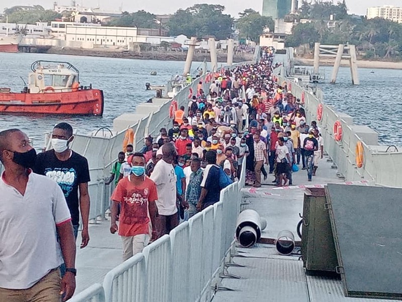
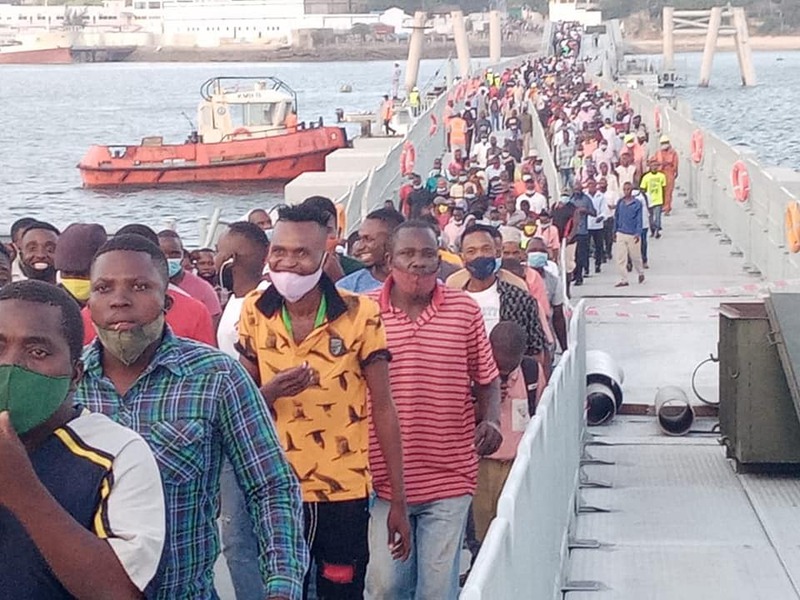
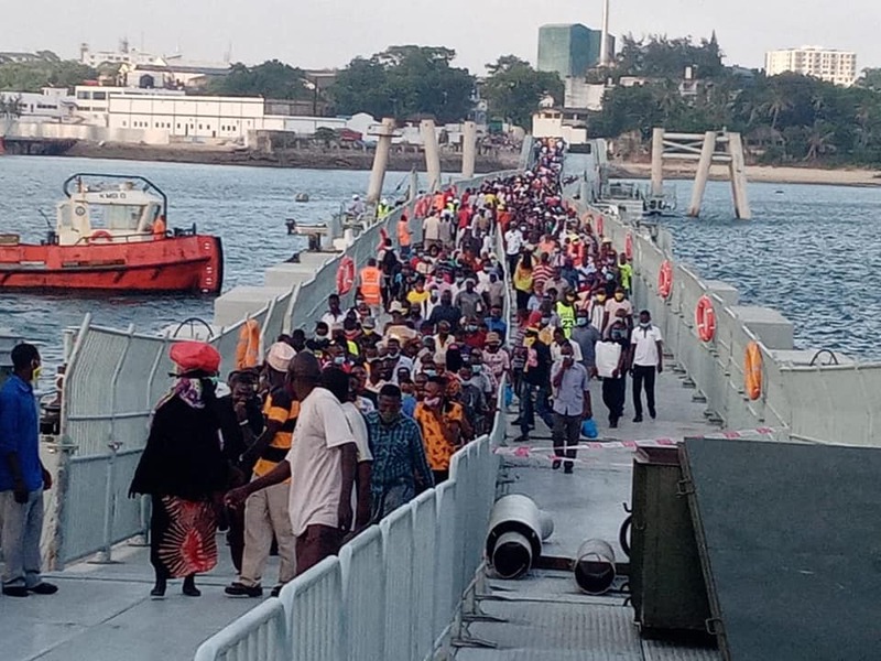
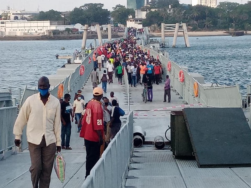
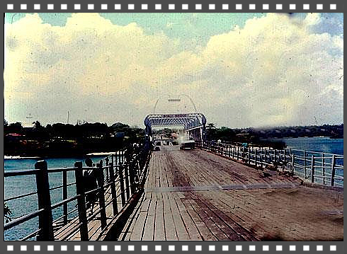
Kenya's Floating Bridge is First of its Kind in Africa | Mombasa-Likoni Floating Bridge
The total length of bridge is 721mtrs, North trestle to the Standard Pontoon is 248mtrs, the opening and
shutting section of the Standard Pontoon is 241mtrs (the floating part) and the South Trestle is 188mtrs (all measurements are to its nearest).
Standard Pontoon is 241mtrs (the floating part) tidal adaptation that allows the opening and shutting through on-board motors moving and allowing the Pontoon to open on water surface (through gateway
action) giving an opening access of 150mtrs to Shipping traffic, the Bridge deck is 6mtrs in width and joined with prefabricated bailey truss on both sides propped up on Steel Pipe Piles that
continue towards North and South Trestle.
Looking at it, I believe this is only made for pedestrians to cross over to and from the Island to the mainland and vice-versa. Likoni Ferry services has to continue to allow vehicles from the Island
to the mainland or divert its traffic through Dongo Kudu Bypass....
There is also Dongo Kudu Bypass that relieves Likoni area off any congestion that is currently under construction, phase one is complete.
Photos credit to Rishi Arun Parikh

NYALI BRIDGE
Click below and open PDF
Kindly provided by Tony Chetham
This link between the island & the mainland to the north was officially opened in 1931 by the then Governor of Kenya, Sir Joseph Bryrne. Prior to this , one had to use a ferry to cross to the mainland, and several of these existed.
old-nyali-bridge.pdf
Adobe Acrobat document [6.8 MB]
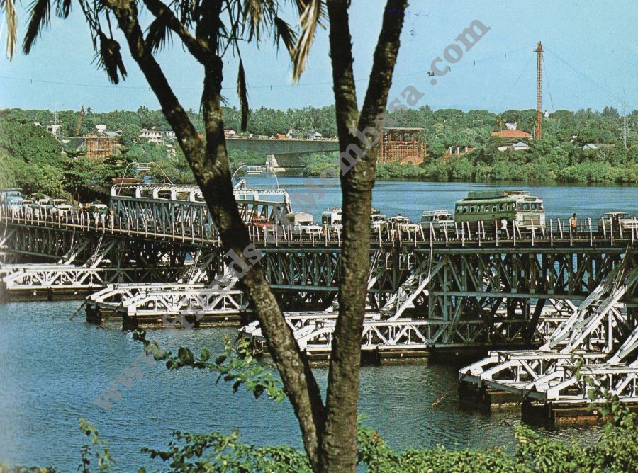
Nyali Bridge
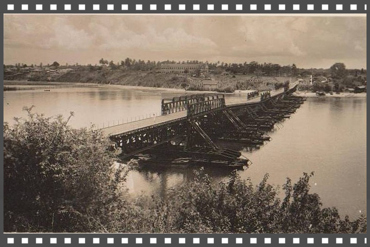

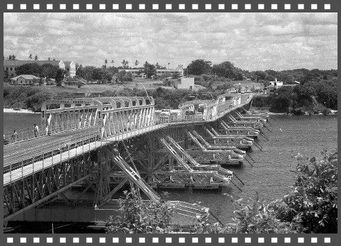
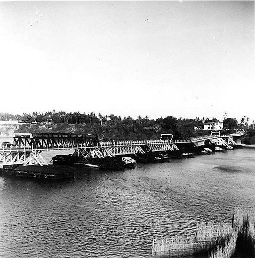

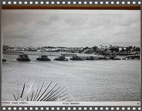
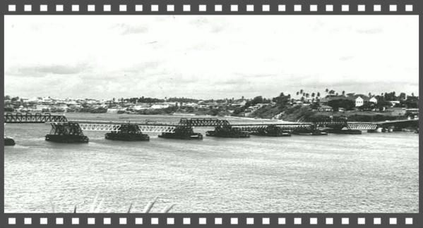
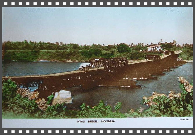
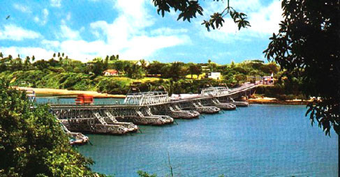

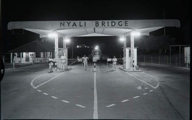
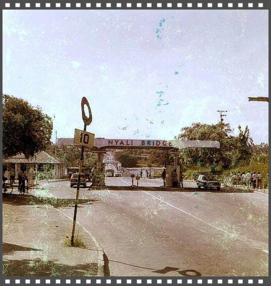
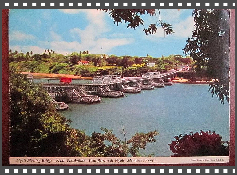


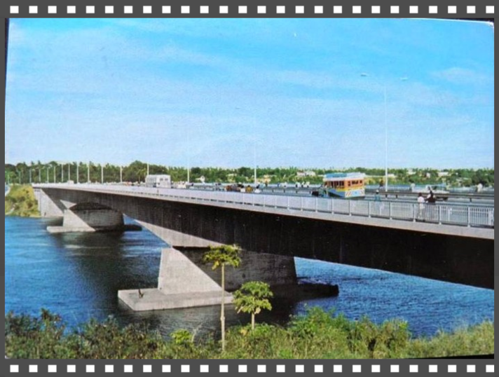

 The Nyali Bridge was a floating pontoon bridge linking Mombasa Island to the Kenyan mainland. The bridge linked the Mzizima district of Mombasa to Nyali, and was built in 1931. In 1980, the bridge was superseded by the New Nyali Bridge (located approximat
History and Development of Bridges in Kenya
By Eng. Cleophas N. Makau: MBA, Bsc(Civil Eng), R.Eng, MIEK . Manager in charge of Structures KeNHA
A bridge is a structure built to span physical obstacles such as a body of water, valley, or road, for the purpose of providing
passage over the obstacle. Designs of bridges vary depending on the function of the bridge, the nature of the terrain where the bridge is constructed, the material used to make it and the funds
available to build it.
The history of Bridges in Kenya stretches before the colonial times when the indigenous community would use tree logs and rock boulders or rock fill across ‘unfriendly’ sections of the footpath. The
‘unfriendly’ sections included swamps, rivers and gorges. The crossing points along the footpaths largely followed the narrow crossings and where the banks were stable like where the river/ gorge
bank has rock outcrops would be preferable.
Cont:
History and Development of Bridges in Kenya
The Nyali Bridge was a floating pontoon bridge linking Mombasa Island to the Kenyan mainland.
The bridge linked the Mzizima district of Mombasa to Nyali, and was built in 1931.
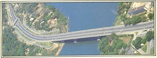
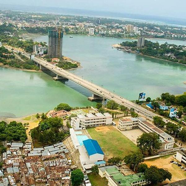
In 1980, the bridge was superseded by the New Nyali Bridge (located
approximately 0.55 miles (0.89 km) to the north), leaving the steel bridge to be dismantled for scrap.
1931 - Nyali Floating Bridge
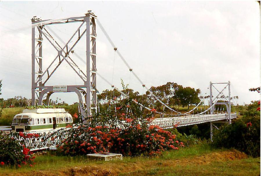
1958 - Mtwapa Suspension Bridge (toll bridge) but the ferry remained operational :
Mtwapa bridge Act
http://kenyalaw.org/kl/fileadmin/pdfdownloads/Acts/MtwapaBridgeActCap402.PDF
Kilifi Bridge….1991. https://wn.com/above_kilifi_bridge
Nyali concrete bridge built 1980
Mtwapa Concrete Bridge 1980
Both bridges can be viewed, new one under construction in the distance whilst old one still in use...
There is a lot that could have been done in terms of keeping historical Mombasa keep its hereditary intact:
a) Kenya has had a new infrastructure in terms of its Chinese Railways, they could have easily salvaged all its old discarded Railways and put into use all around the country. A simple route would
have been from Mombasa’s old railways station to Makupa Causeway and onto the mainland and fanning out towards Port Ritz and beyond heading towards, Mtongwe, Likoni and Tanga…
The old railway lines could have been used for transportation branching out of Mombasa in all sorts of direction, they could have easily had a transport system all the way to Malindi, Tanga etc, to
boost and generate commercial, that would have inevitably reduced/relieved Likoni Ferry from congestion too, instead of paying millions of USD$ to the Chinese in building a new Floating
Bridge.
b) Kenya has got rid of the old Nyali Bridge that too could still have served a purpose, the old Nyali Bridge was scrapped and its scrap metal sent to China , who actually benefited, nobody
seems to know.
c) There are many issues in Mombasa in relation to traditional artefact, historical infrastructures, new buildings that have gone up and made it a disaster and eye sore to the beauty
that many of us seen and experienced over time.
Old Town historical buildings are crumbling but nothing being done about it for obvious reasons. Recently along the shores of lighthouse there was a dispute about historical land being sold off to some businessman…..etc,
New Nyali Bridge
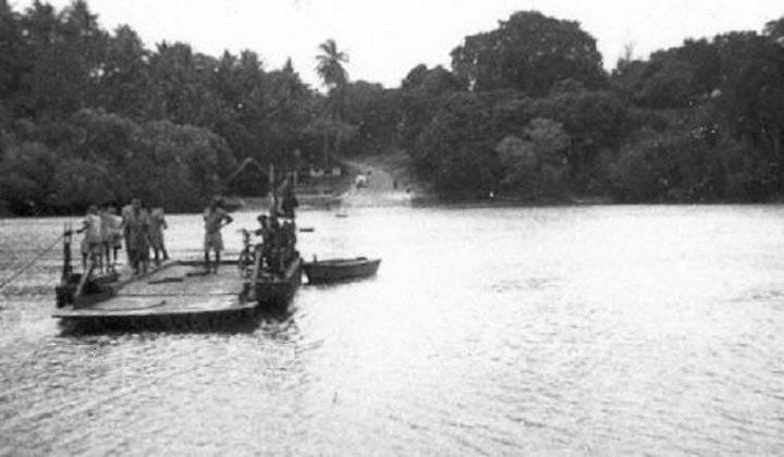
Shimo-Le-Tewa Ferry 1950's
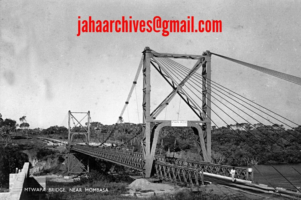
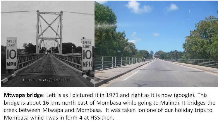
Mtwapa Bridge
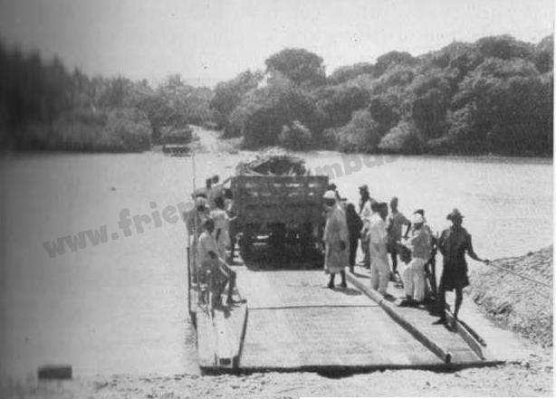
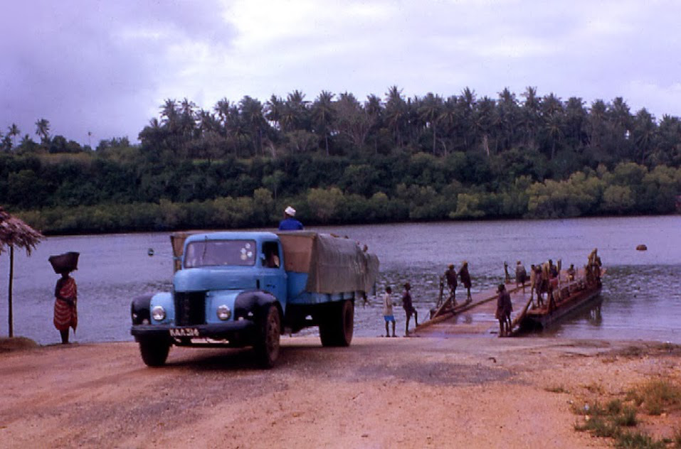
Mtwapa Creek Ferry early 1950s-
Picture shows two vehicles being ferried across Mtwapa Creek on the Mombasa-Malindi Road some 10 miles north of Mombasa. According to native legend the Creek, the local name of which is Shimo la Tawa (Hole of the Rock Cod), is the haunt of a giant man-eating rock cod. At the crossing place the creek is spanned by a chain which passes over pulleys at either end of the ferryboat. To effect a crossing a group of six to eight ferrymen travelling on the boat haul on the chain and so pull the boat across. Date: 1 January 1952
 Click on Photo for more on Mtwapa Bridge
 Click above
Built some time ago, Mtwapa Bridge was built in 1958 and largely replaced the "singing ferry". , there was agreement between the government and the company that if the government was to take over this bridge it was to wait eight years before taking over, and then give notice of one year if they intended to do so accordingly to the agreement; the eight year period will end in the middle of 1966. Then the government should be in a position to take over the bridge if found to be appropriate to do so. The Bridge at Mtwapa , if we take it over, would cost something like £130,000.00 and about £5,000.00 for running the Bridge if the Government takes it over.
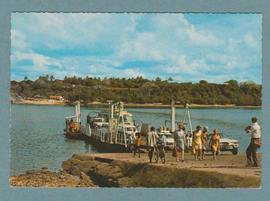
Kilifi Bridge
Photos & videos around Port of Kilifi, Kenya (port details | map)
http://ports.com/kenya/port-of-kilifi/photos/#/show-gallery?o=photo-36
KILIFI CREEK
The bridge was completed in 1991 to ease movement of goods and people which was hitherto done via a ferry.
https://askumo.com/kilifi-creek/
The bridge was completed in 1991 to ease movement of goods and people which was hitherto done via a ferry.Kilifi progressed from chain to motor boats, it was around 1952 or between 1952 and 1955.
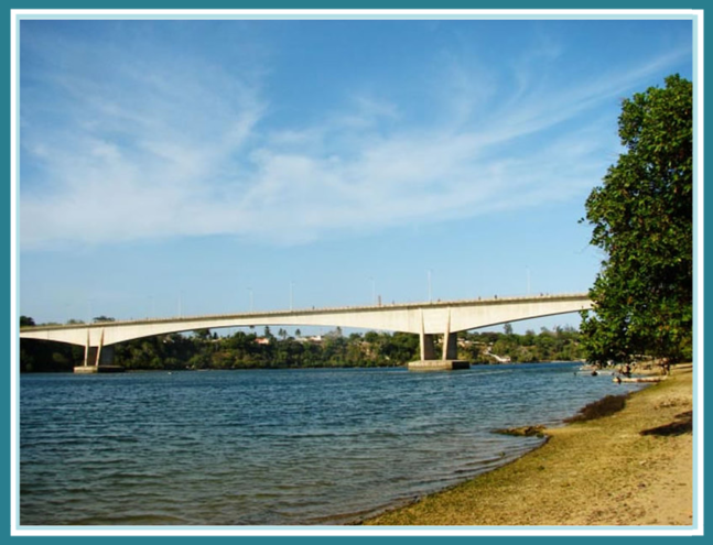 Click above for more on Kilifi Bridge


News
 Click above for Kenya
 Click above for Uganda.
 Click above for Tanganyika.
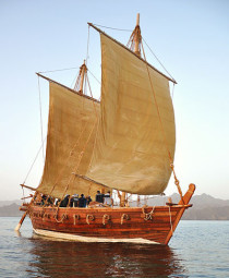
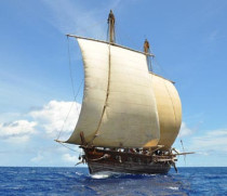
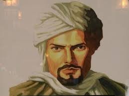 Ibn Battutah ( click for more)
 Click for more on Zeng He
 Click for more on Vasco Da Gama
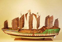
 Zeng He Routes
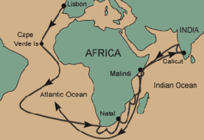 Vasco Da Gama Routes
 Click above
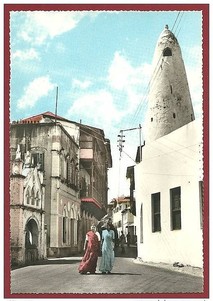 Click on Photo, visting Mombasa
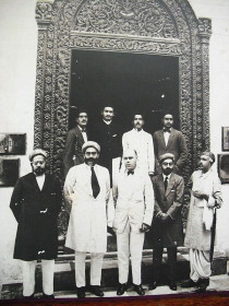
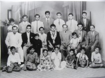 Typical Indian Family & Friends
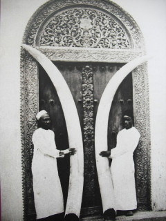
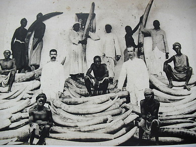 Ivory was major trade of Indians/Europeans/Arabs in E/A
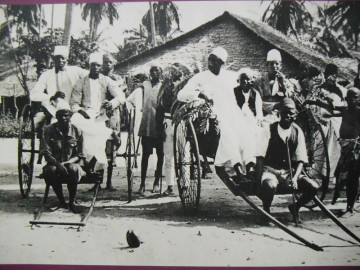 Early Rickshaw
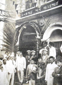 Ithnasheri Guest house 1926 opening (Click on photo)
 Karimjee Business deal 1924
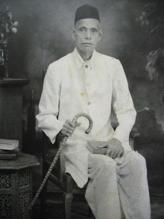 Businessman Sunderji Nanji Damodar
 Click above