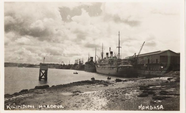
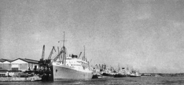
Kilindini Harbour,Mombasa—in the making, the Gateway to Kenya & Uganda
Trade grew, and a stone lighter age quay was constructed at Kilindini…
Mombasa possesses all the romantic essentials. A coral island in four degrees south latitude; its palm trees glistening under the tropic sun or swaying to the swing of the monsoon winds, and with the red flag of the Sultan of Zanzibar floating over its ancient citadel—nothing is lacking.
The entrance channel from the Indian Ocean is flanked on either side by coral reefs. These extend for many miles to the north and south and their lagoons at low tide display a kaleidoscope
of warm colour steaming into the land-locked harbour, the strategical importance of which is the despair of the amateur artist....
Continued below on PDF file....
Trade grew, and a stone lighter age quay was constructed at Kilindini…
Kilindini Mombasa a.pdf
Adobe Acrobat document [436.0 KB]


Historical Timeline
1890
The history of The Port of Mombasa dates back many centuries from the existence of the Old Port. The Port served dhows from India, Arabian Gulf and Far East. It is located near Fort Jesus at Mombasa Old Town. In 1890, Kenya and Uganda became a British Protectorate under the Imperial British East Africa (IBEA). The colonial government saw a need to create infrastructure inland to open up the area for effective administration, hence the construction of the Kenya- Uganda Railway (1895-1902). Coupled with increased activities at the Port there was need for a more spacious and convenient place to meet the demand and for construction of a rail network. Therefore the Port of Mombasa was relocated to the Kilindini Harbor West of Mombasa Island. The development of the present Port of Mombasa commenced in 1896 when the first Jetty, used for discharging materials for the construction of the railway line was built at Kilindini.
North Lighter Wharf
1907
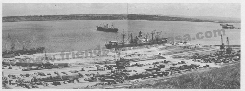
In 1907 a wharf, the North Lighter Wharf was built with quay length of 168 meters long to handle rail-borne goods and other imports and exports. The north lighter quay had four lighter handling points. Later in 1954 a South lighter wharf built with 8 stub-head jetties to keep up with expansion rate.
Berth No. 9
1913
In 1913, berth no 9 was constructed to handle then Kenya's leading mineral export (Soda ash).
Berth Nos. 1 and 2
1926
Berth nos. 1 and 2 were completed in 1926, supported by double storied sheds.
Berth Nos. 3,4, 5 and the Shimanzi Oil Terminal (SOT)
1929 - 1931
In 1929, berth nos. 3 and 4 were completed and were supported by ordinary transit sheds. In 1931, no. 5 and the Shimanzi Oil Terminal (SOT) were completed. The SOT was to handle refined oil.
Berth Nos. 7 and 8
1942 - 1944
Berth no 7 and 8 were constructed between 1942 and 1944 to cope with the sudden increase in shipping and traffic as a result of British wartime naval requirements in the Indian Ocean, during the Second World War.
Berth No. 9
1955 - 1958
In 1955 berth no. 9 was completed as deep water berth, followed by berth no 10 in 1958.
Berth Nos. 11 and 12
1961 - 1967
As the level of cargo and ship traffic continued to rise berth nos. 11 and 12 were completed in 1961. Kipevu Oil Terminal was built in 1962/ 63 to serve the east African Oil Refinery while berth 13 and 14 were later completed in 1967.
Mbaraki Wharf, Berth Nos. 16, 17 and 18
1970 - 1980
1970 saw Mbaraki wharf built to handle specialized dry bulk cargo. This includes cement and fluorspar, clinker among other bulk cargoes. The Wharf comprised of two berths of 312 meters long. Containerization concept started in Greece in the mid1950s and spread like bushfire, in the global maritime transport due to convenience and security advantages containers come with. The Port of Mombasa handled its first container in 1975, and the experience of handling the few containers heralded the emergence of containers in the maritime sector in the region prompting the construction of berths nos. 16 and 17 and later in 1980 berth no 18 was completed to facilitate container cargo handling. This became the Mombasa Container Terminal with its initial capacity of 250,000TEUs per year.
Inland Container Depot(ICDs)
1980 - 2000
As cargo volumes continued to grow at Mombasa Port it became apparent that there was high usage of road haulage compared to train for up-country bound cargo and beyond the borders. This is because the railway line was old and slower. To promote the usage of rail and to bring cargo closer to customers, the Authority introduced the Inland Container Depot(ICDs) concept by building ICDS in Nairobi and Kisumu, which were linked to the Port by a Railway line (Railtainer service).The concept was also to reduce cargo congestion at the Port. Consequently, in 1984, inland container depot (ICD) at Embakasi in Nairobi was built and became operational while Kisumu inland container depot became operational in 1994, together with Eldoret ICD. Cargo moves ex-hook from the Port of Mombasa on a through Bill of Lading onto a waiting rail wagon directly to the ICD. At the ICDs all cargo clearance procedures are done and the owner can make payments and collect their cargo. Exports are also consolidated and railed to Mombasa for loading onto ships.
Port Channel Dredging
2011 - 2016
In 2011 the Port channel was dredged to minus 15 meters and its turning basin widened to 300 meters. Alongside berths are now 12 meters deep. In the same year, a new berth no. 19 was built and completed in 2013. The berth is 240meters long and 13.5 meters deep capable of handling panama vessels. This addition effectively makes Mombasa Container Terminal to have a total quay length of 840meters. In the same year, the construction of a second container terminal commenced in phases. Phase 1 was completed in February2016 and started operating in April 2016, with a quay of 350 meters long berth and draft of 15 meters, and a side berth of 210 meters long with a draft of 12meters. The two berths have a capacity of 550,000TEUs per year. The second and third phase are expected to be completed in 2020 in time to facilitate Kenya's Vision 2030.
https://www.kpa.co.ke/AboutUs/Pages/KPA-History-Introduction.aspx
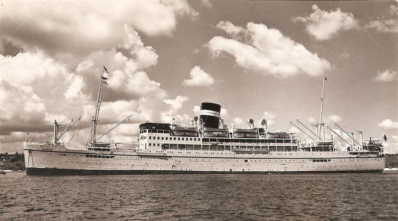
British India Line
Kampala / Karanja / Kenya / Uganda
 Click above
 Click above
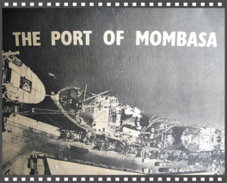
History, From the days of dhows to containerisation
THE PORT OF MOMBASA can trace its history back many centuries to a time when dhows called at the Old Port on the north side of Mombasa Island.
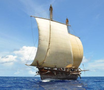
The Old Port is next to Fort Jesus, which was built by the Portuguese navigator Vasco da Gama. This was during the famous spice trade between the Arabian Gulf, the east coast of Africa, the Indian subcontinent and the Far East when navigators were looking for a new route to the Far East.
In the 18th and 19th centuries East Africa was colonised by various nations including Great Britain and Germany. In the 1890s the region was partitioned, with Tanzania coming under German control and Kenya and Uganda being controlled by Britain.
http://www.kpa.co.ke/About%20Us/Pages/History.aspx
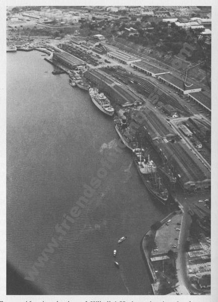
Kilindini Harbour is a large, natural deep-water inlet extending inland from Mombasa, Kenya. It is 25-30 fathoms (45-55 meters) at its deepest center. It serves as the harbour for Mombasa, with a hinterland extending to Uganda and Sudan. Kilindini Harbour is the main part of the Port of Mombasa, the only international seaport in Kenya. It is managed by the Kenya Ports Authority (KPA). Apart from cargo handling, Mombasa is frequented by Cruise ships.
"Kilindini" is an old Swahili term that means "deep". The port is so called because the channel is naturally very deep. Kilindini Harbor is an example of a natural geographic phenomenon called a ria, formed millions of years ago when the sea level rose and engulfed a river that was flowing from the mainland.
ROYAL NAVY HARBOUR DEFENCES - KILINDINI HARBOUR, MOMBASA

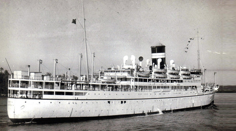
There was once a ship called SS Karanja
https://owaahh.com/there-was-once-a-ship-called-ss-karanja/
https://wesaidgotravel.com/kenya-to-india-memories-and-an-old-friend-from-the-s-s-karanja/
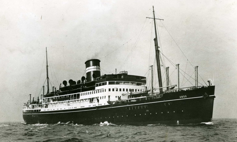
Voyages between Mombasa and Bombay – SS Khandalla and SS Amra
TYNE BUILT SHIPS
A history of Tyne shipbuilders and the ships that they built
Port Reitz, Mombasa

Mombasa: The “Island of war”…. Port Reitz
Situated on the Eastern coastline, bordering the Indian Ocean, Mombasa is Kenya’s second largest city and the top coastal destination. The city, originally known by
its Arabic name منبعثة Manbasa, was popular as ‘Kisiwa Cha Mvita’ Swahili for “Island of War”, due to the many changes in its ownership. Sitting on an island it is separated from the
mainland by two creeks Tudor and Port Reitz. Port Reitz has a District Hospital, one can fly from Mombasa Airport at Port Reitz, it also has a very large Industrial area…etc, so how did that area get
named Port Reitz?
Lieut Reitz is forgotten and left unheeded beneath a duka in Old Town. Some of you may recall that he accompanied- Capt. Owen when Leven and Barracouta set out from Woolwich in 1823 on an exploratory
and mapping expedition to the East African coast.
When the ships arrived at Mombasa the local inhabitants, who were tired of fighting with Seyyed Said, resolved to give up their country to the English. So they approached Capt. Owen.
This cautious officer remarked that if the people of Mombasa would desist from the slave trade he would transmit the proposal to the home Government. In the meantime he would hold Mombasa for them.
And so, Lieut. Reitz, a 22-years-old officer became the first British commandant of the Fort. His term was short, however, for he died three months later, Capt. Boteler records the
funeral:
The burial took place in what was the ruins of a Portuguese church. A grave seven feet in depth was dug near an immense piece of masonry, which alone indicated, where
the altar once stood.
The corpse decently arrayed in fine cambric, was conveyed to the church, followed by a procession of the first people of town. The funeral service was read and the body consigned to the earth with
military honours. A humble specimen of Arab masonry plastered over and washed marks the spot.”
Port Reitz was named after the lad. The old church stood where the Bohra Mosque now stands in Ndia Kuu. Zuru, Kenya & Edward Rodwell
HMS Leven… http://en.wikipedia.org/wiki/HMS_Leven_%281813%29
HMS Barracouta .. http://collections.rmg.co.uk/collections/objects/540856.html
Zuru Kenya
Shimanzi, Kipevu & Port Reitz
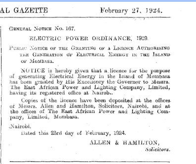
Accordingly to Mombasa’s history on Electricity narrated by Kenya Power “1875: Seyyied Bargash, the Sultan of Zanzibar, acquires a generator to light his palace and nearby streets.
1908: Harrali Esmailjee Jeevanjee, a wealthy merchant in Mombasa, acquires the generator and transfers it to the Mombasa Electric Power and Lighting Company. "
1922: The two utilities in Nairobi and Mombasa are merged under a new company incorporated as the East African Power and Lighting Company (EAP&L).
On 27th Feb 1924 an application in the Official Kenya Gazette that was made under Electric Power Ordinance 1919 an appropriate licence granted to East African Power and Lightening for generating
electrical energy, application made via Allen and Hamilton Solicitors.
Subsequently that allowed the introduction of Berth of Nos. 3,4, 5 and the Shimanzi Oil Terminal (SOT) 1929 – 1931.
In 1929, berth nos. 3 and 4 were completed and were supported by ordinary transit sheds. In 1931, no. 5 and the Shimanzi Oil Terminal (SOT) were completed. The SOT was to handle refined oil.
Kipevu spans towards Changamwe North/west and West ward towards Port Reitz, both situated on mainland of Mombasa.
News
 Click above for Kenya
 Click above for Uganda.
 Click above for Tanganyika.
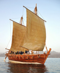
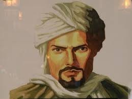 Ibn Battutah ( click for more)
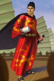 Click for more on Zeng He
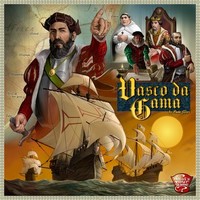
 Click for more on Vasco Da Gama
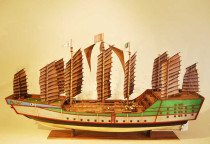
 Zeng He Routes
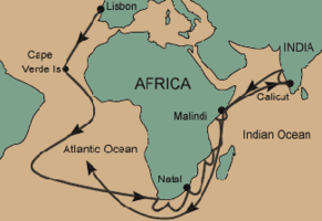 Vasco Da Gama Routes
 Click above
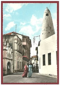 Click on Photo, visting Mombasa
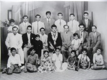 Typical Indian Family & Friends
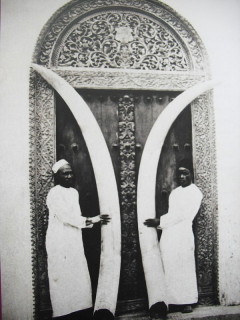
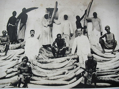 Ivory was major trade of Indians/Europeans/Arabs in E/A
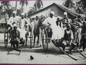 Early Rickshaw
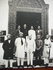
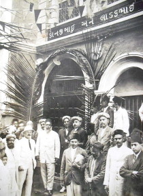 Ithnasheri Guest house 1926 opening (Click on photo)
 Karimjee Business deal 1924
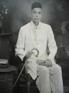 Businessman Sunderji Nanji Damodar
 Click above